
Detour No. 7: Siletz Bay National Wildlife Refuge

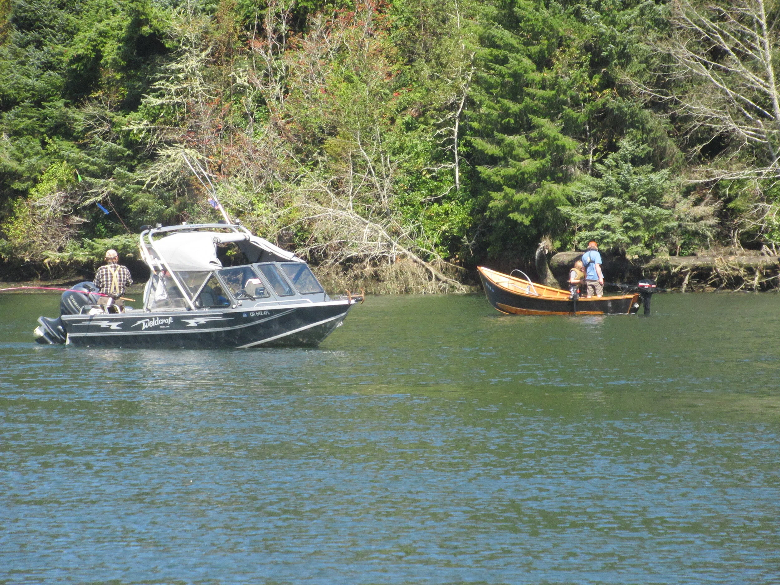
After about three miles walking south from Lincoln City along the side of Highway 101 you pass Highway 229 right before the Siletz River Bridge. On the east side is Siletz Bay National Wildlife Refuge. Its small parking lot allows for no RVs or trailers, and dogs are not allowed out of cars.
It is another of the six National Wildlife Refuges (NWRs) comprising the Oregon Coast National Wildlife Refuge Complex (I already covered Nestucca Bay National Wildlife Refuge). It was closed to public use when I first retired to Oregon. But now the site is home to a kayak launch, a nature trail that opened in 2017, and, at the eastern end of the nature trail, a bench with fishing spot nearby.
Siletz Bay NWR was established in 1991 with a donation of 46 acres of tidal salt marsh. The goal was to protect and enhance estuary fish and wildlife resources and their habitats.
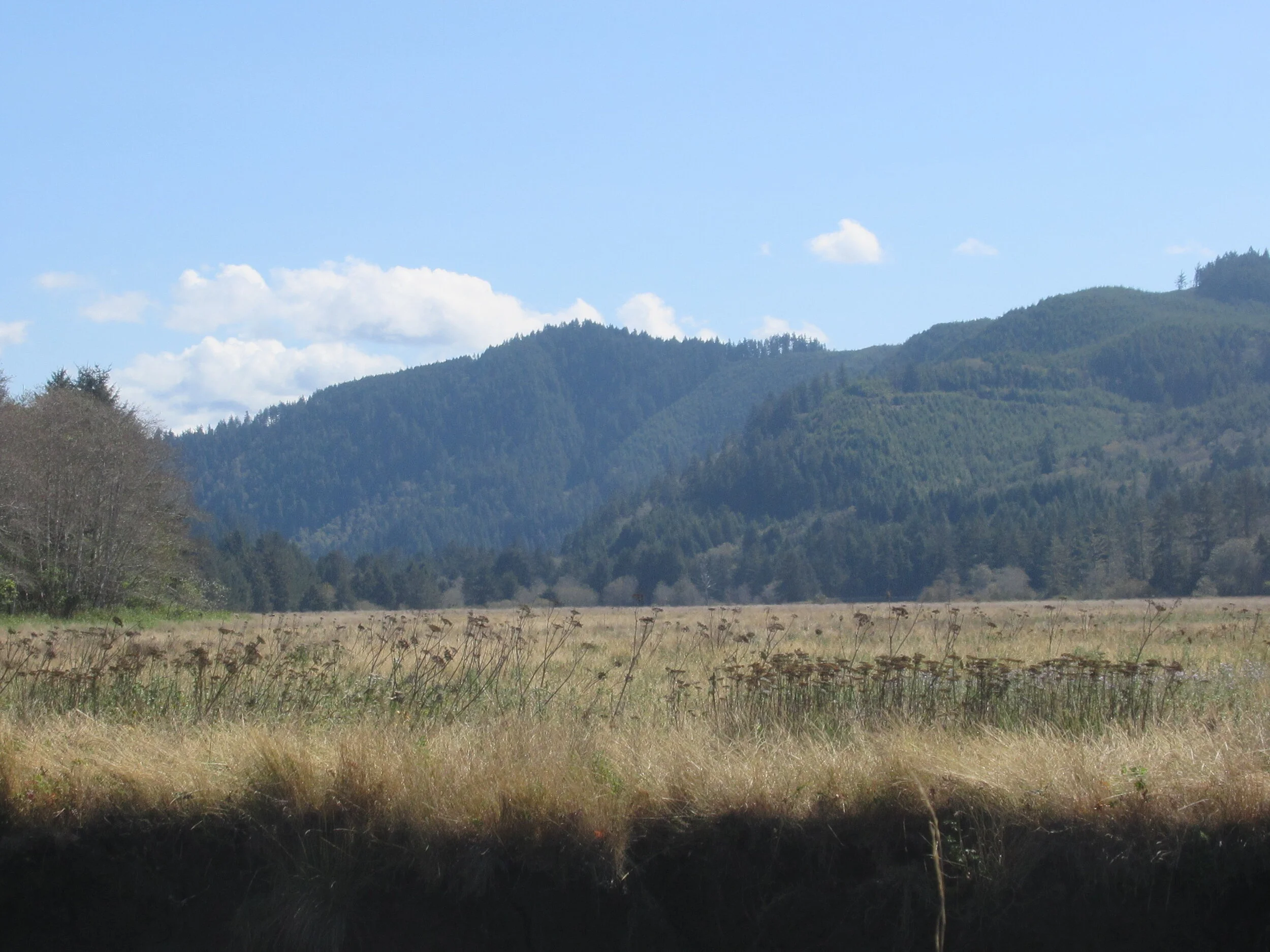
Other projects included a small tidal marsh restoration project in November 2000 and, in 2003, another project restored 86 acres of tidal marsh at Millport Slough with help by Ducks Unlimited and the Confederated Tribes of the Siletz Indians. Now, at 568 acres, the refuge provides nursery grounds for Coho and Chinook salmon, steelhead and cutthroat trout, and other anadromous species (fish born in freshwater who live the majority of their lives in the ocean and return to spawn in streams).


So, rather than continue on Highway 101 — it’s Dave Detour Time.
It is really hard to get lost on this detour. You walk a quarter mile from Highway 101 on pavement, the Alder Island Nature Trail has a sign pointing persons in a counterclockwise direction. After walking half a mile on the trail, you walk back to Highway 101.
It is a quiet area, good for a snack or longer rest break. For your eyes and ears it includes hard and soft wood stands and water fowl. I have seen an eagle once or twice, and sometimes Roosevelt elk are seen (but not by me). I have better luck at Cascade Head or Reedport’s Dean Creek Elk Viewing Area.
Final Tally: One mile of additional picturesque opportunity with Dave’s Detour before returning to Highway 101. It’s your choice.
Some last thoughts:
The word on the Oregon Coast Trail for 2020 might best be summed up by the Bonnie Henderson blog, “'Closed'? Maybe, but still hike-able in sections.”
This year I have yet to get to Kilchis Point, Whalen Island and Bayocean Spit.
I have yet to hike Salishan Spit — possibly seeing 150 to 200 harbor seals; Cooper Ridge and Mike Miller Trail at South Beach; the Woodland Trail in Waldport; and various trails in Yachats — especially Gerdemann Gardens in the spring when the rhododendrons are in bloom.
The trail will probably remain closed in 2021 for many of the same reasons.
So, plan on doing sections — take time to see what is before you. Benches need job security, take some time to stop and see what is in front of you.
I mentioned in several articles the state of Oregon removed the old Oregon Coast Trail maps since new ones were to be produced spring 2020. If you Google search “OCT maps”, the webpage still has this line, “NOTE: Our OCT maps are currently in development. We apologize for the inconvenience. Check back soon.” If you didn’t previously save the maps, you might be discouraged. Confession time: The maps have not entirely disappeared. And, since this is the last one of this year’s detours, here is the hack. Go to Oregon State Park Brochures webpage. Scroll down to Ocean Shore State Recreation Area. It has the 10 maps and other good info, I especially like “Oregon Beaches A Birthright Preserved (1977)” covering how we didn’t lose the Oregon Coast to private ownership.