
Dave’s Detours: Cape Lookout

By Dave Powell
For the TODAY
I really was planning to take one or two weeks off from articles. After the hiatus, I would cover my two flowering beauty detours. But last week’s event brought a story that needs to be told.
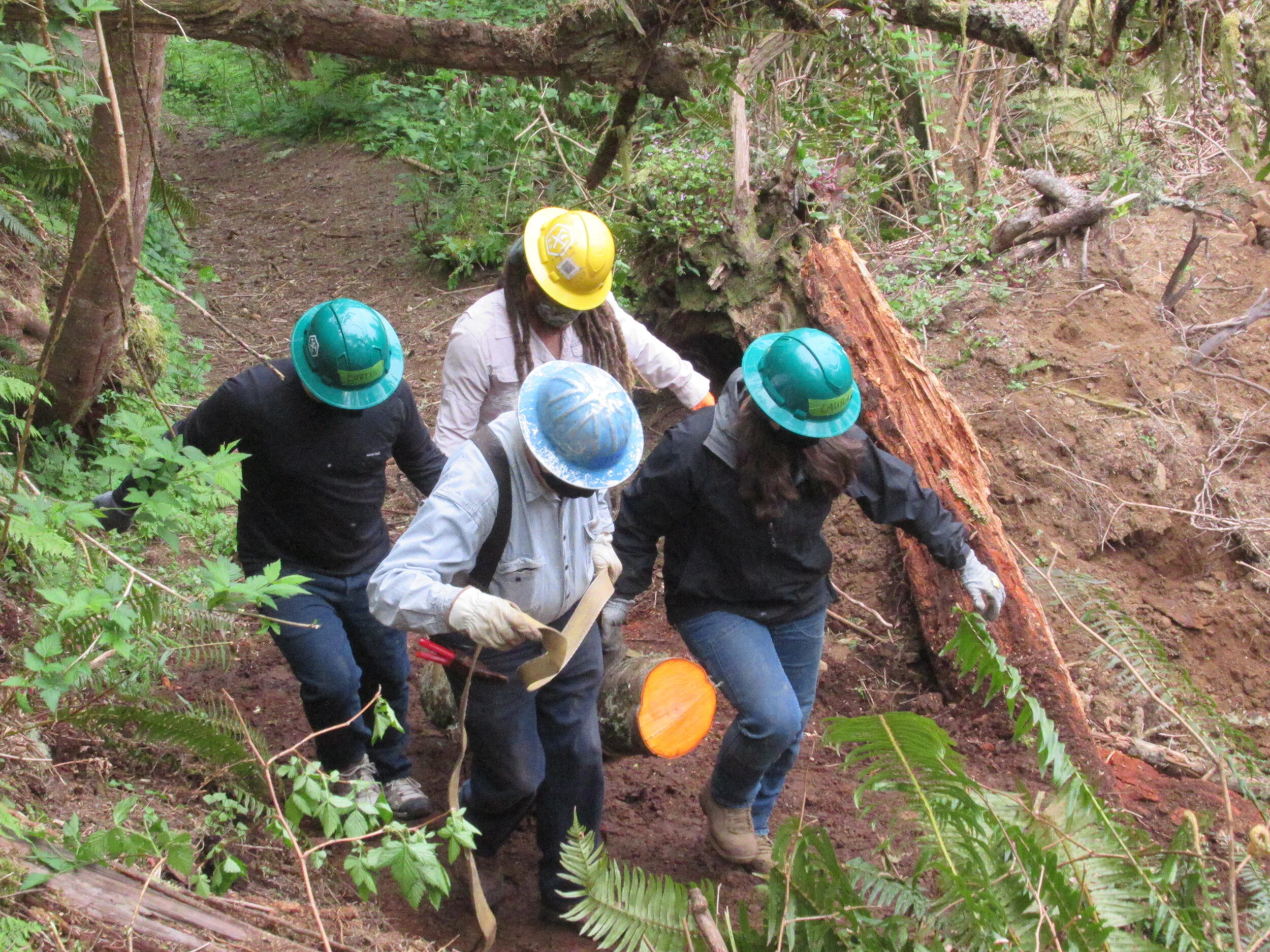
It is a good day, not raining or too hot. And there are six of us working on a Trailkeepers of Oregon project. It is the second day of a four-day project — and this four-day project will be followed by more four-day projects. The next one is already set for May 6 to 9 and, with the goal to reopen two (Cape Trail and South Trail) of the three trails at Cape Lookout, I would figure another one after that.
We are first let into the locked trailhead, and then told the history of the Native Americans who originally lived here. With the land appropriated and the Native Americans moved to reservations (after many treaties broken), the land passed to Europeans. We are now given a safety talk covering tools and work environment. We are given an idea what today’s project will entail. Finally, we are reminded that TKO work parties have three priorities: safety first, fun second, and work third. We then go past a barricade which states, “Notice: Trails closed due to extensive damage and downed trees from the Labor Day wind storm. Access is strictly prohibited. Violators may be cited under ORS 736-010-0040 (8f).
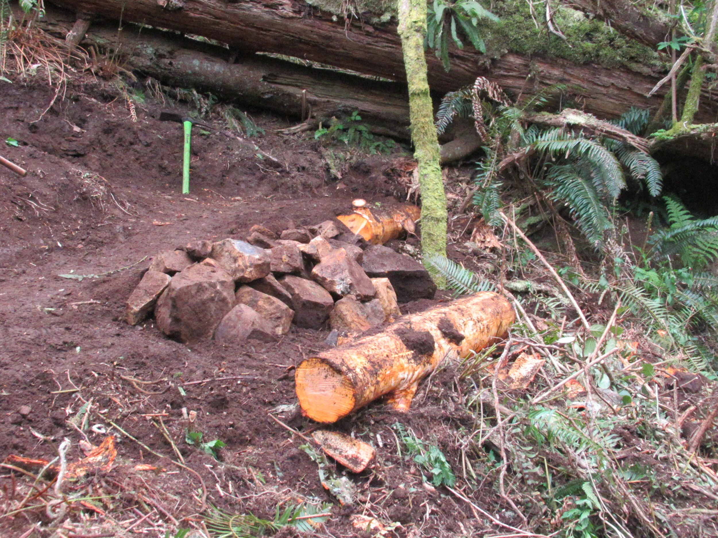
We are working on the Cape Trail — a two-and-a-half-mile trail out, and the same distance back (go figure!). If we get through everything on our list, we will only get about half the way out. We will build some new trail, as two trees fell in the 2020 Labor Day wind storm and a reroute is essential. Further up the trail is a section of trail that needs to be refilled. And the trail also needs some annual maintenance such as clearing brush using loppers and hand saws.
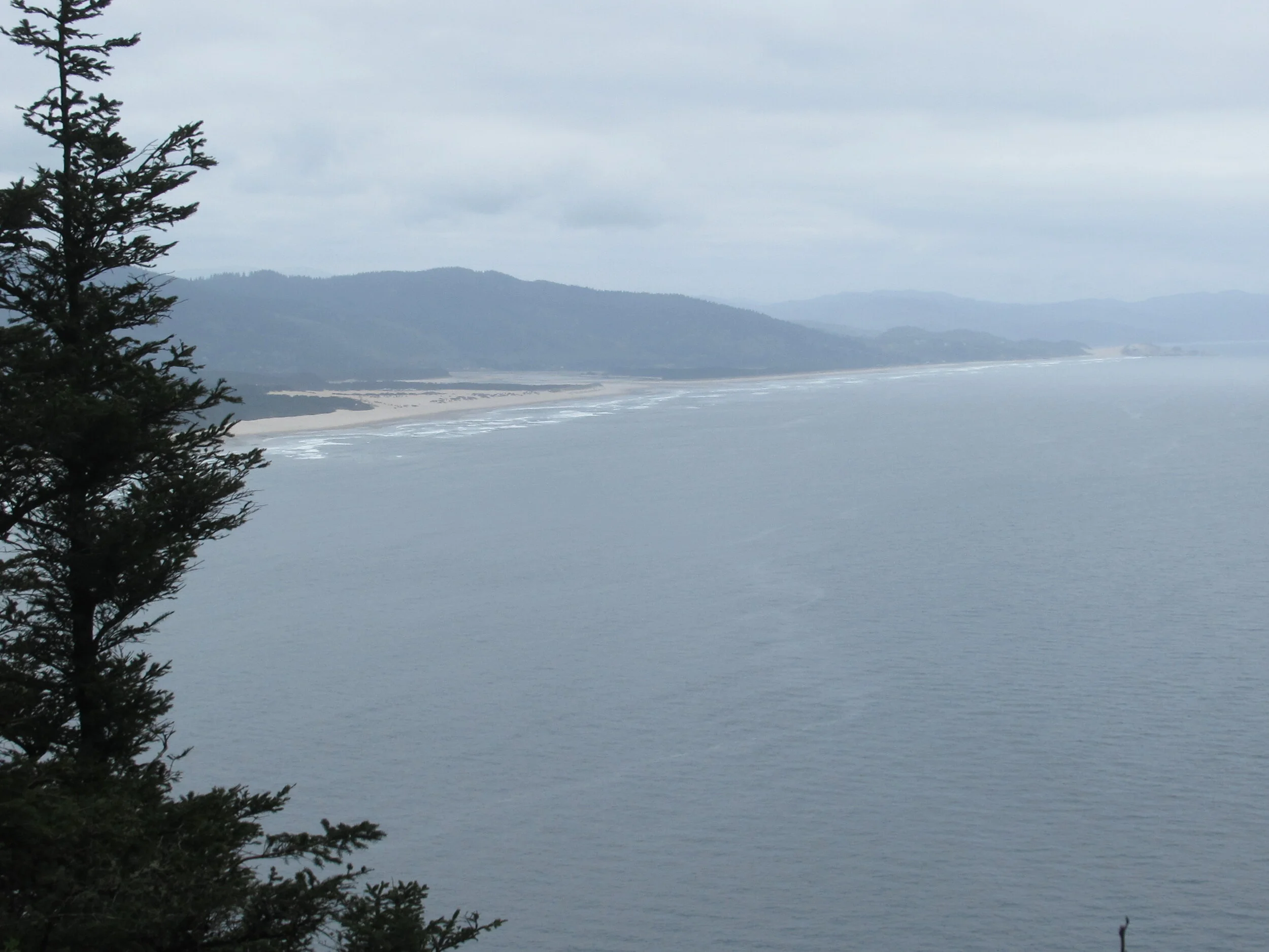
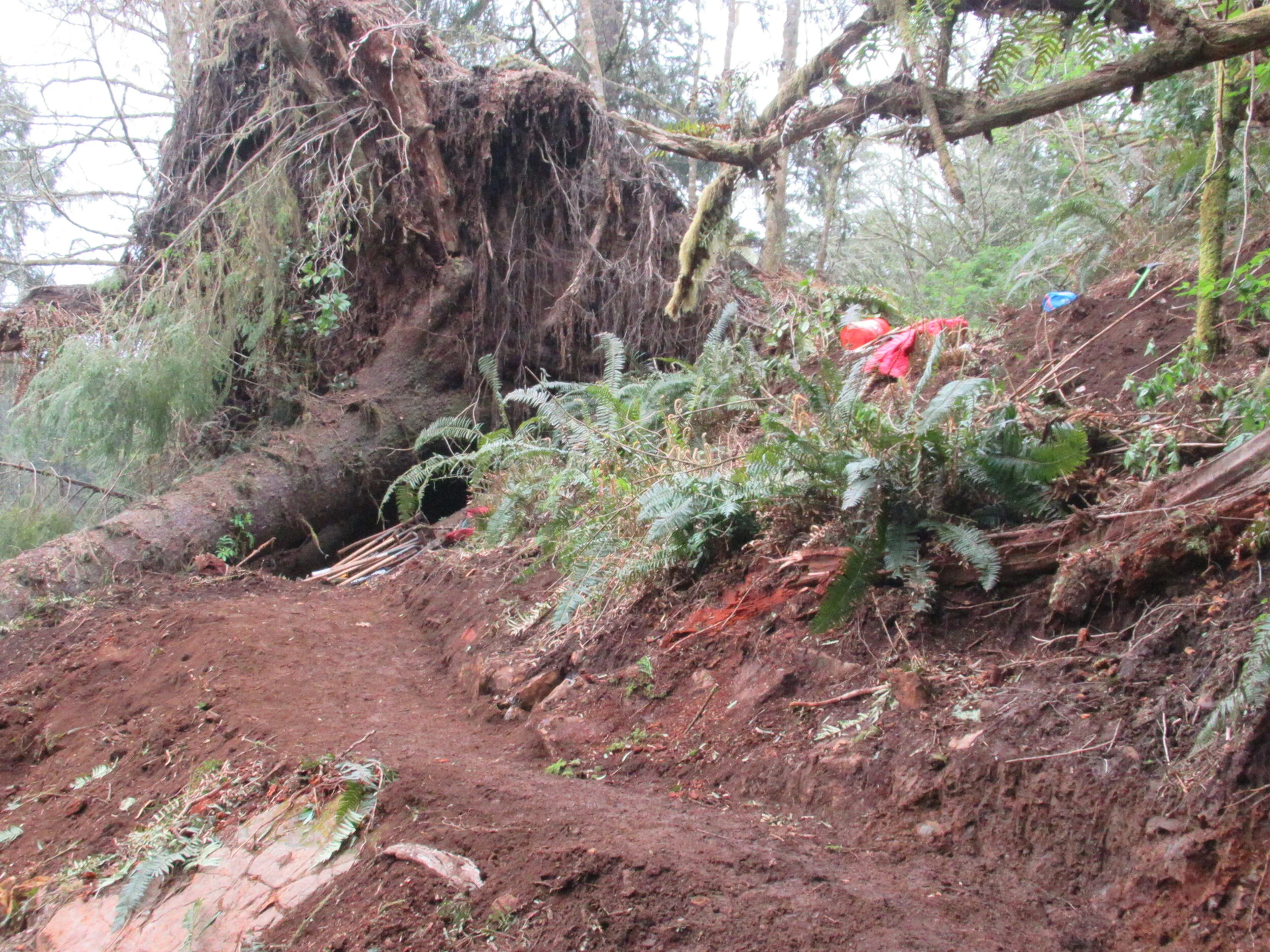
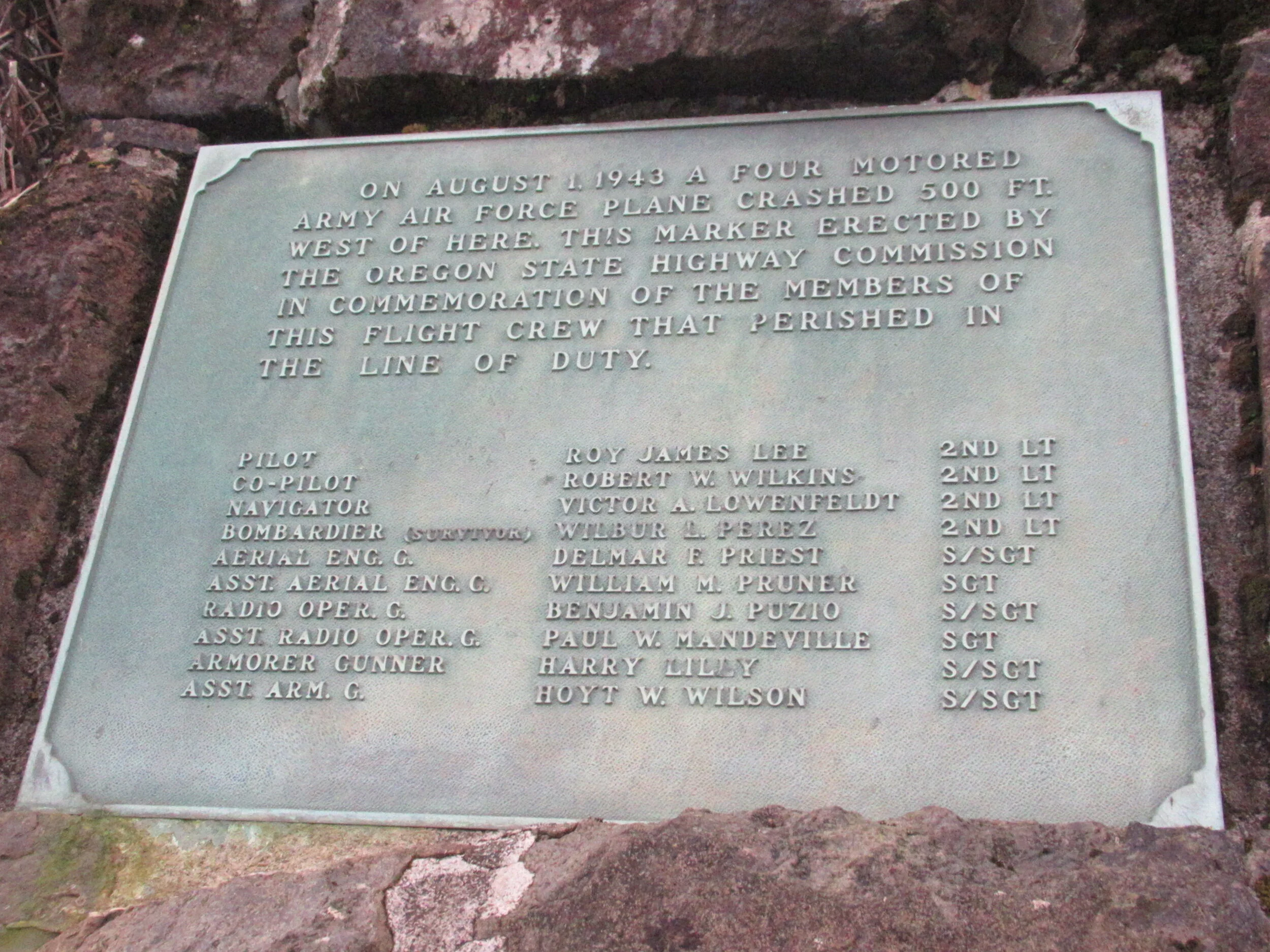
At just over half a mile on the trail is a plaque in memory of a plane crash into the side of Cape Lookout. Although several crew members survived the accident, by the time help reached the isolated area only one, Wilbur Perez, lived to tell the tale. After another tenth of a mile is a new trail section where we worked to replace trail destroyed by two trees and their root balls. Another tenth of a mile was a shattered tree — the top taken off, the bottom section twisted and broken. Finally, another third of a mile got us to an ocean view. After all this, we have only covered half the entire trail, so we don’t get to the 1992 trail failure into the ocean or the boardwalk over muddy sections.
After we finish working for the day, Ranger Travis showed us the North Trail. We don’t even reach my first Garmin mark point, only 100 yards up the trail. Although the elevation is roughly 800 feet, the mountain nearby is roughly 2,000 feet (you can’t see the top because of the angle). The winds funneled down to destroy a pristine Sitka Spruce stand. They don’t know how to even fix it, and it will possibly be several years before the trail re-opens. The only idea I have is a zip line — it is that deforested.
Final Tally: What I walked with the TKO work party was a total of just over two and a half miles. When the trails are open, the Cape Trail will be five miles of detour. And, although the new state 2021 Oregon Coast Trail map shows the route taking the North and South trails at Cape Lookout, the North Trail will of course be replaced with hiking Cape Lookout road until the trail is fixed or relocated.
Also, a short detour at Cape Lookout that won’t be there this year. The Park Nature Trail near the ranger registration booth won’t be done this year as salt invasion is affecting the trees and shrubs.