
Dave’s Detours: Oceanside

By Dave Powell
For the TODAY
Although new Oregon Coast Trail (OCT) maps were released this spring, last fall’s wind storm necessitates more hiking on roads as several trails (like the North Trail at Cape Lookout) will not reopen until 2023. I am using that as an excuse for more detours. Last year near Oceanside I had one detour — this year I have two.
In “The Hitchhiker's Guide to the Galaxy” Arthur Dent (and his towel) are saved from Earth’s destruction by Ford Prefect, an alien from the vicinity of Betelgeuse. The Guide itself says, “A towel is just about the most massively useful thing an interstellar hitchhiker can carry. Partly because it has great practical value. ... More importantly, a towel has immense psychological value.”
If having a towel was important for Arthur and other hitchhikers, tide tables are important for the detours around Oceanside. Both detours are much better at low tide.
Walking down from Cape Meares toward Oceanside the OCT route heads south to Symons State Scenic Viewpoint.
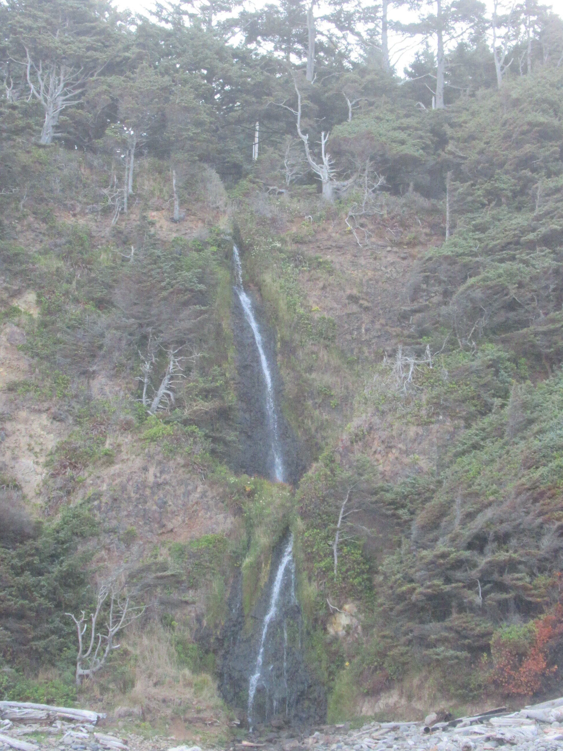
The first detour is Short Beach at the three-and-a-third-mile mark (near Radar Road) on the Cape Meares Loop Road as you head downhill toward Oceanside. Short Beach is best in the summer and at low tide, otherwise it is ankle-twisting cobbles. The path down to the beach has 125 stair steps, going beside concrete-steered Short Creek. The bulk of the beach is north, including Larson Creek waterfall. The waterfall helped contain a beach fire on August 4. This year had two other beach fires — Crissey Field on July 28 (beach fires had already been banned) near the California border and at Rockaway Beach. Parts of the Columbia Gorge and Pacific Crest Trail are still closed because of fires, reminding us to appreciate what we have and be safe.
The second detour is to Oceanside Beach State Recreation Site. Coming further down the Cape Meares Loop Road junctions Highway 131 at Pacific Avenue. You could turn right, go to Oceanside State Park and reach the beach. Entering the park is a plaque for Warren McMinimee — Tillamook County resident, state senator, State Parks and Recreation Advisory Council for 20 years — who supported public use of parks.
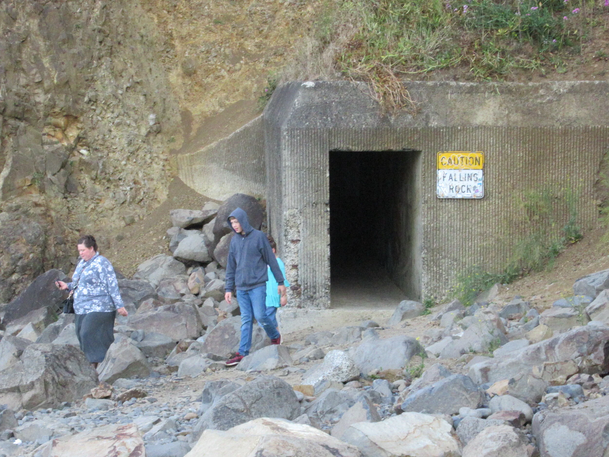
Walking north on the beach is a tunnel roughly 50 yards in length at Maxwell Point finished in 1926 by the Rosenberg family. They then built a walkway 20 feet higher to reach the more secluded Lost Boy Beach further north. During World War II it was closed to the public and used by the military. In 1979 a rock slide closed the tunnel completely, and it wasn’t reopened until the early 1990s. Further slides have occasionally closed the tunnel. On Dec. 5, 2020, there was a landslide and several people were rescued from the north side. The tide guide is important in case of a slide, especially if your luck is as “good/bad” as mine. You won’t be stranded since you can go around Maxwell Point because of enough sand gain in the summer at low tide.
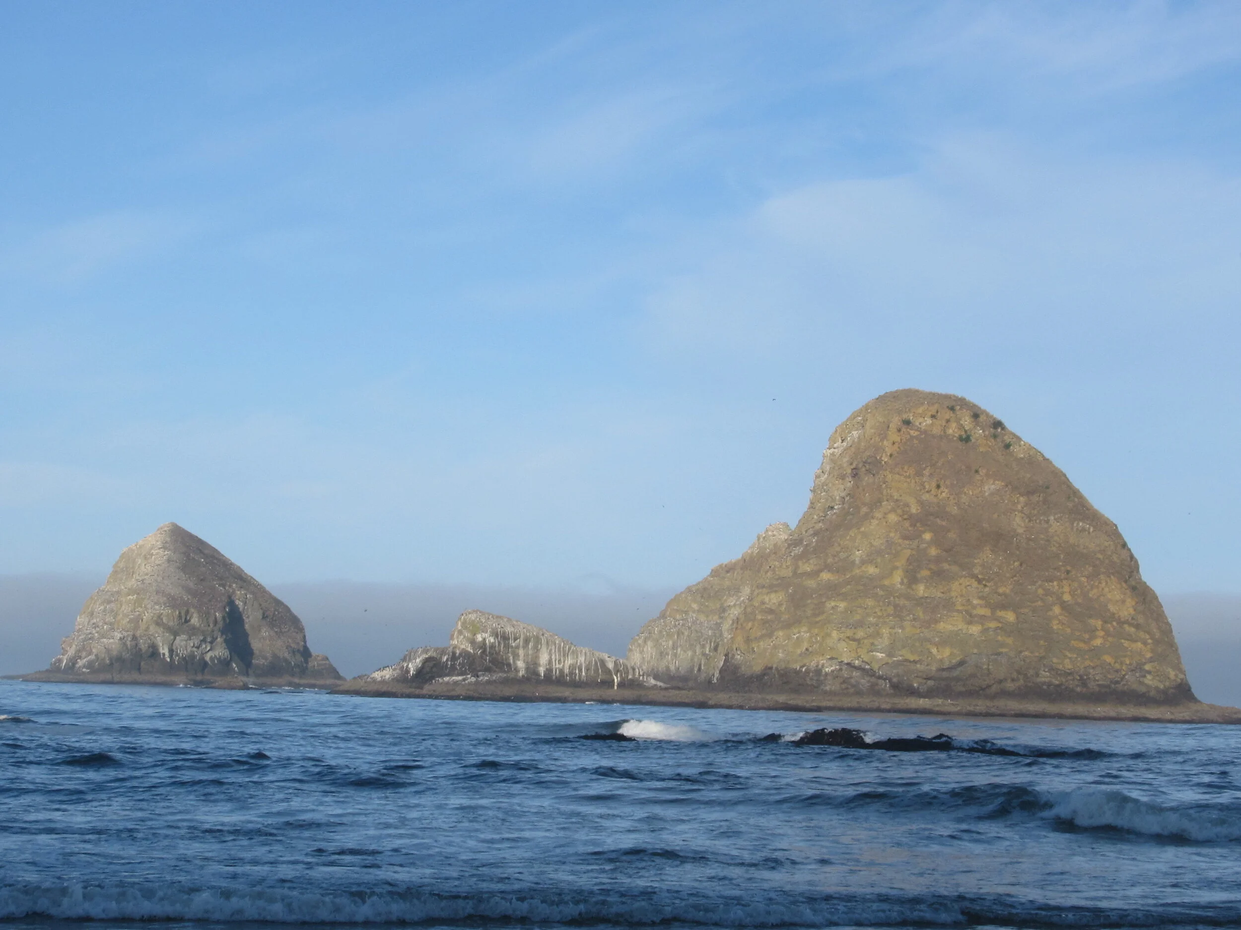
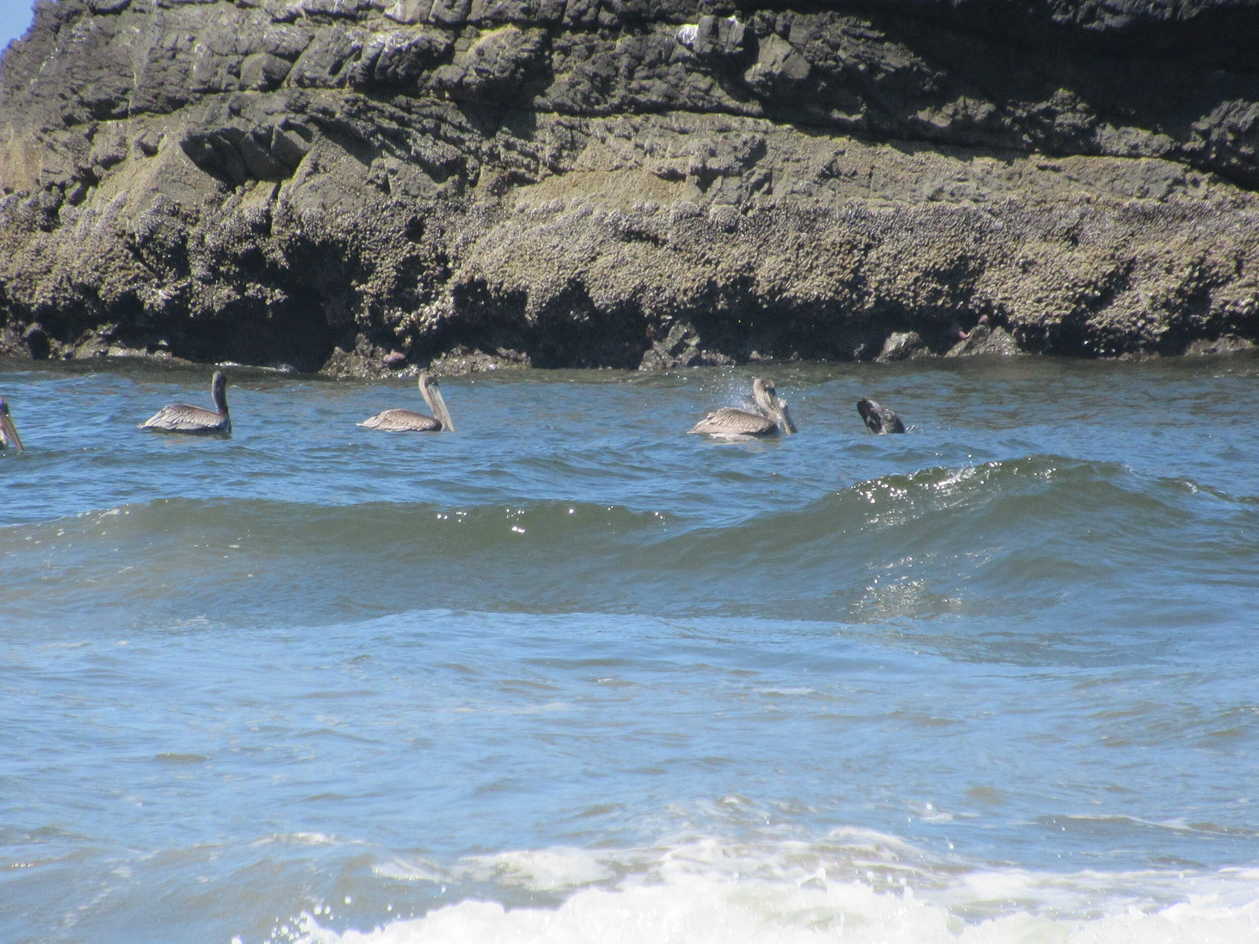
When you reach Tunnel Beach you are visually in the midst of Three Arch Rocks National Wildlife Refuge. Established in 1907 when Theodore Roosevelt received reports of seabirds being killed, the refuge has three large and six small rocky islands just offshore — featuring the largest colony of breeding tufted puffins and a large common murre colony. Since its founding, the refuge has been home to Oregon's largest seabird nesting colony of more than 230,000 birds. The scenery changes seasonally and daily. Nesting season has bird noise and flights with meals for the chicks. It could be calm, with brown pelicans diving for lunch; or windy, for pictures of crashing surf over the rocks or flying kites; or a place to check out the tidal creatures.
After spending time at Tunnel Beach, go back through the tunnel and continue south on Oceanside Beach and eventually you will rejoin the OCT at Symons Viewpoint.
Final Tally: Two and a half miles (one mile at Short Beach and one and a half at Tunnel Beach) of additional picturesque opportunity with Dave’s Detour before walking south to Netarts. It’s your choice.
• The suspension bridge on the Amanda Trail at Cape Perpetua will be closed for construction starting Oct. 1, with the closure running possibly as long as Feb. 28, 2022. No trail detour is available. The trail on the north side of the Amanda Statue will have intermittent closures during this same period. When that occurs, notices will be sent out via City of Yachats, the trails committee, visitor center, chamber, and local Facebook pages. Orange construction fencing will be erected in the immediate construction area.