
Daves’ Detours: Yaquina Head
By Dave Powell
For the TODAY
Since August is Marine Reserve Awareness Month — and others are covering it — I will detour to other sites of wildlife importance (no, not bars!)
Some things have changed in the past year and some have not. I’m “grounded.” Several weeks ago, my wife fell and her upper arm is broken into three pieces. Several days later, since her chest hurt worse, X-ray confirmed three ribs were cracked. I guess I will now have to stay closer to home.
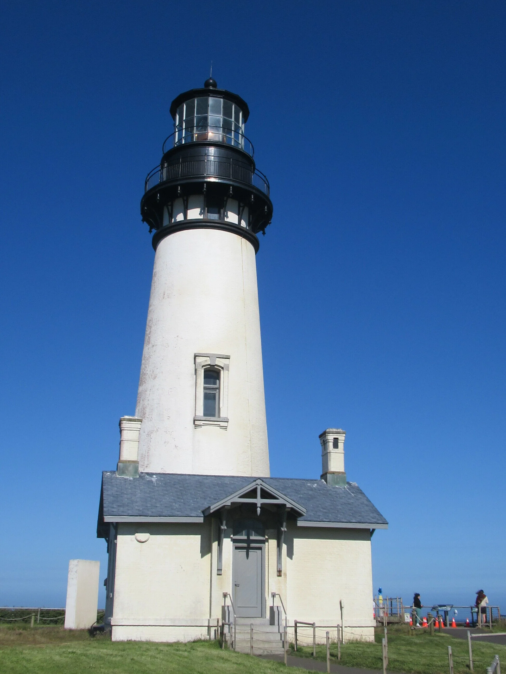
At Yaquina Head the visitor center and lighthouse are still closed, with slight changes. The lighthouse needs a new coat of paint. The old lead paint has been removed but the new paint still needs to be applied. Of note, the main water tank at Yaquina Head was lead-lined. The Roman Empire’s use of lead to “sweeten” the taste of water continued until the danger of brain damage was discovered. As for the visitor center, the exhibits remain closed but the gift shop and restrooms are available. A sad note, the peregrine falcon nest failed with the death of the female “queen.” There are also restrooms at the lighthouse parking lot, and the Cobble Beach has been reopened.
Last year, Oregon State Parks was to release the new Oregon Coast Trail maps. COVID pushed that release to this spring, so the beach exit north of Yaquina Head was settled between several alternatives. They chose the surfer trailhead at 55th Street.
Heading south on Highway 101 to Lighthouse Drive (it has a traffic light) and you could walk a tenth of a mile down to the beach — or it’s Dave’s Detour Time. Continue straight on Lighthouse Drive as Yaquina Head has three open trails. If you can do only one, I suggest Salal Hill Trail, followed by Lighthouse observation deck (unfortunately the exhibit signs are gone).
Communication Hill Trail is about half a mile from Highway 101 and on the right side. It’s an out-and-back trail of half a mile round trip, with coastal forest. At one point, I can see my driveway. On a clear day, the view from the top includes Cape Perpetua and Mary’s Peak (if the marine layer hasn’t descended).
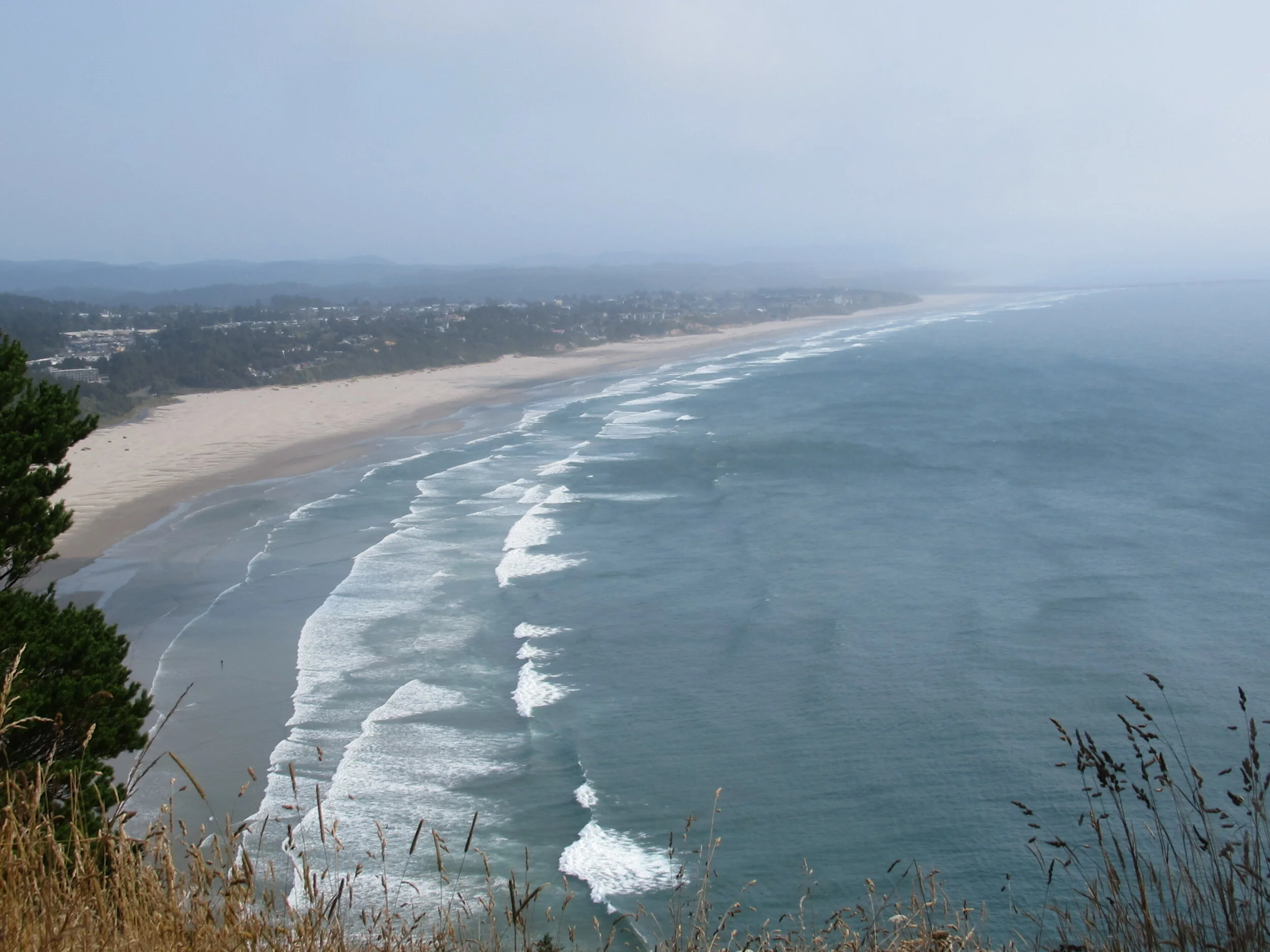
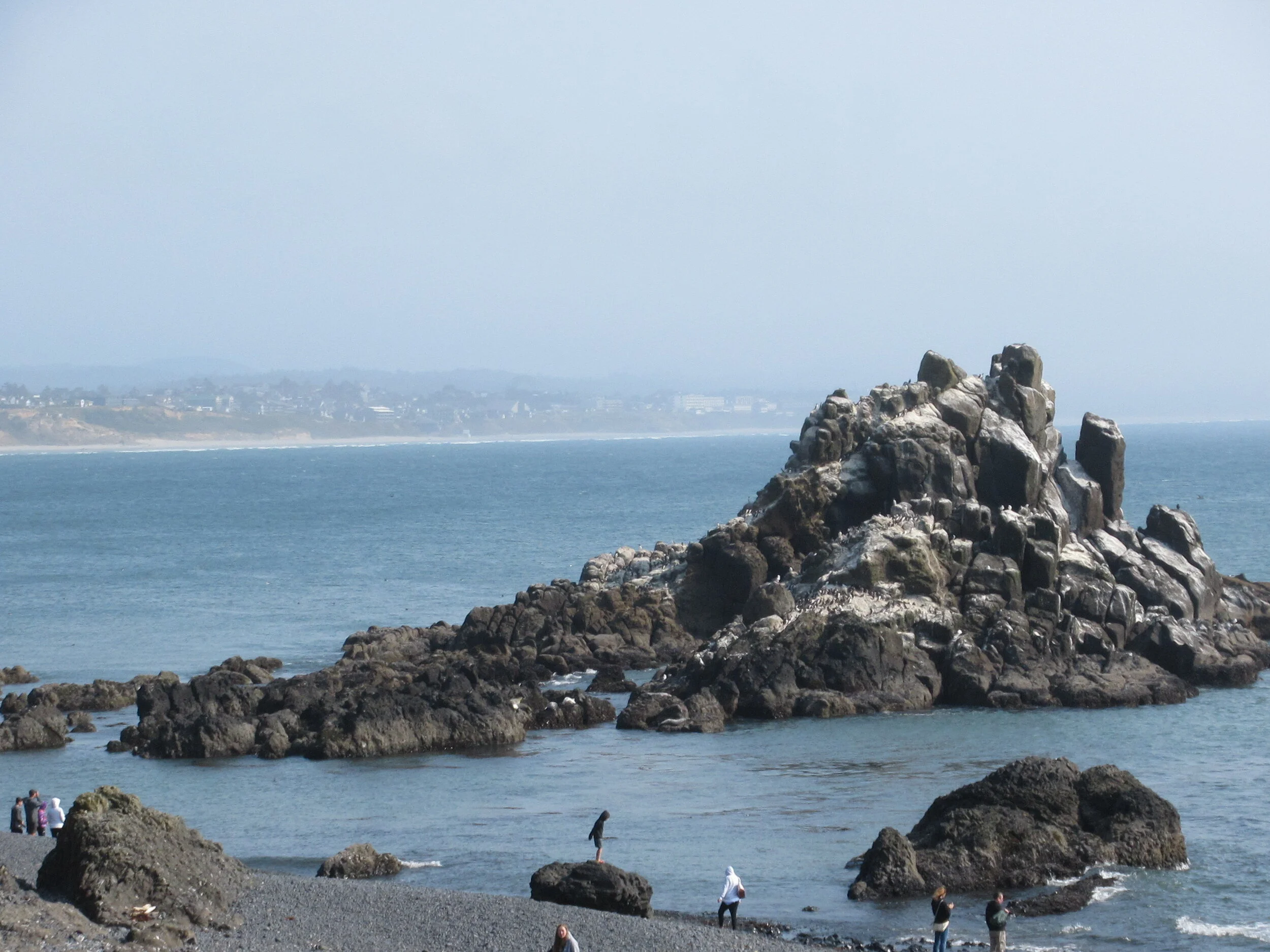
Returning to the main road go west another half a mile to Salal Hill Trail, which starts at the small parking lot and restrooms near the lighthouse. Salal Hill is also out-and-back, covering three quarters of a mile and has the best views. After Salal Hill the Lighthouse deck is about 250 yards. This is not the time for a fast trip around. It is one of the best Oregon sites for whale watching. Look for boats going slowly — they are trailing whales for visitors. Also nesting nearby is one of the largest colonies of common murres, and there are other species of seabirds. Some stats about the lighthouse: construction started in 1871, started operation on August 20, 1873, tallest lighthouse in Oregon at 93 feet with 114 steps, and it has a first-order Fresnel lens so it could be seen 20 miles away. Before COVID closures you could climb up to the top and earn a badge.
Leaving the deck, go east a quarter mile to Quarry Cove Trail on the right/south side. You hike a quarter mile down with good views of beach, surfers, paddle boarders, and sometimes you can watch kites being flown. At trail end at the parking lot (it has a restroom) you can head up/east a third of a mile to exit Yaquina Head and get to ocean beach. You could hike down to the quarry cove or up to the “upper parking lot” it’s a quarter mile roundtrip both ways. I like both sections — a better chance to see marine mammals (usually harbor seals) and more time to watch people playing on the sand and ocean at Agate Beach.
Another detour: as you leave Yaquina Head: instead of going down to Agate Drive to the Beach, you could continue south about 500 feet on Highway 101 to 49th Drive. There is a memorial for Ernest Bloch the composer, and a more secluded trail down to the beach.
Final Tally:
The detour of these three trails totals 4.15 miles.