
Detour No. 3: Cape Perpetua

This article is a little different — there isn’t one detour but several.
South of Yachats the Oregon Coast Trail takes Amanda’s Trail to the top of Cape Perpetua. For years, hikers have awaited a new, higher suspension bridge on the trail as the previous bridges were destroyed by a series of flash floods, and it might happen this fall.
There are many ways to view nature’s sights and increase mileage. Cape Perpetua has a dozen trails. I hiked them all my first year in Oregon, so I mention several that are my favorites.
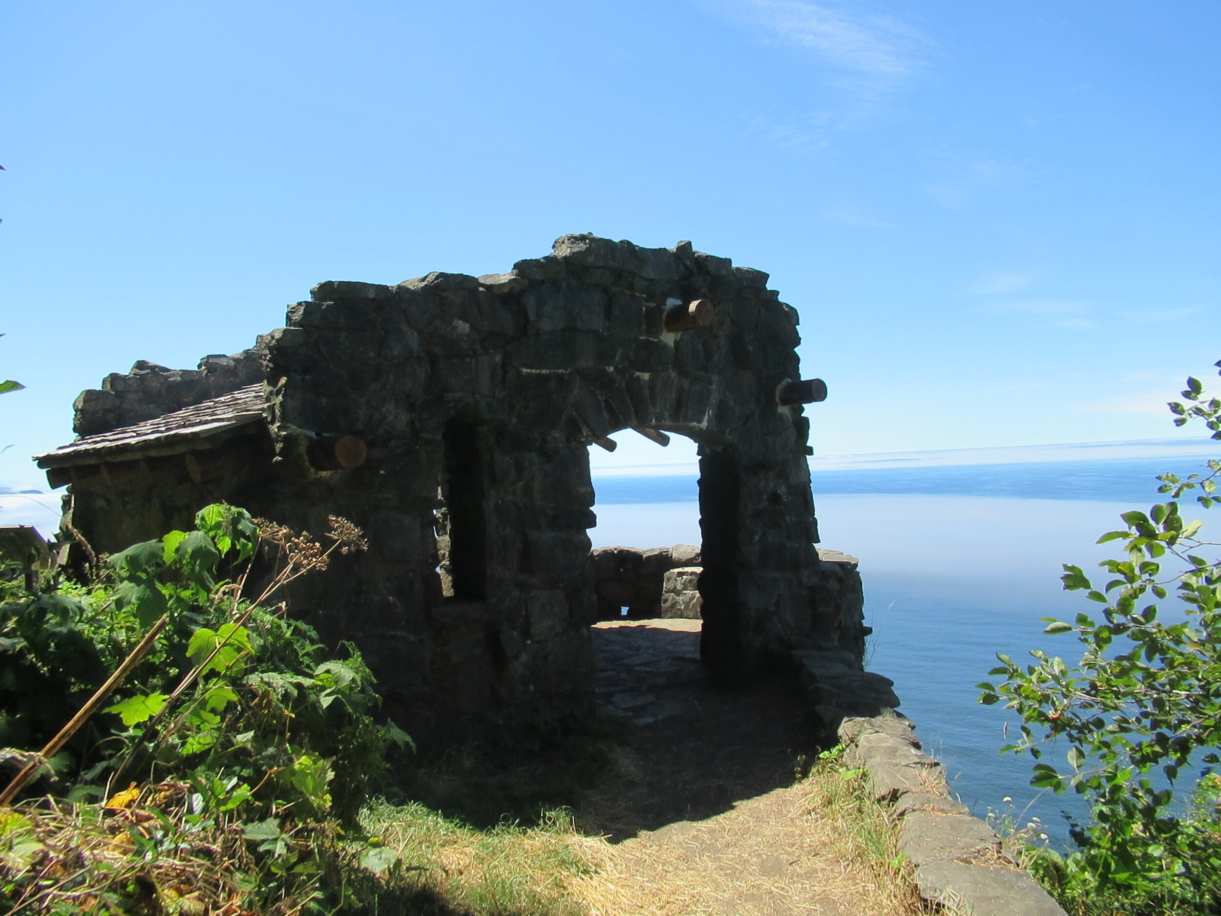
First, is a slight detour from Amanda’s Trail just before the parking lot at the top of Cape Perpetua. Instead of following Amanda’s Trail to the left, you go straight 100 feet. At the junction of Whispering Spruce, go right and after 300 feet you are at the West Stone Shelter. It was built by Civilian Conservation Corps around 1933, used in World War II for observation. In the fall of 2019, it was the subject of restoration work completed by HistoriCorps in partnership with the Siuslaw National Forest. It is on the National Register — and has a great view on clear days. How far is the view? The formula for finding maximum view distance is 1.2 times the square root of the height. For example: 100 feet elevation, the square root is 10; times 1.2 for 12 miles. For the shelter at 800-foot elevation the math is 35 miles.
The panoramic view is a great place for whale watching. On August 1, I immediately spotted a pair and watched for a short time — about 10 minutes. My average on seeing whales is about 75 percent.
Total detour is just under two tenths of a mile.
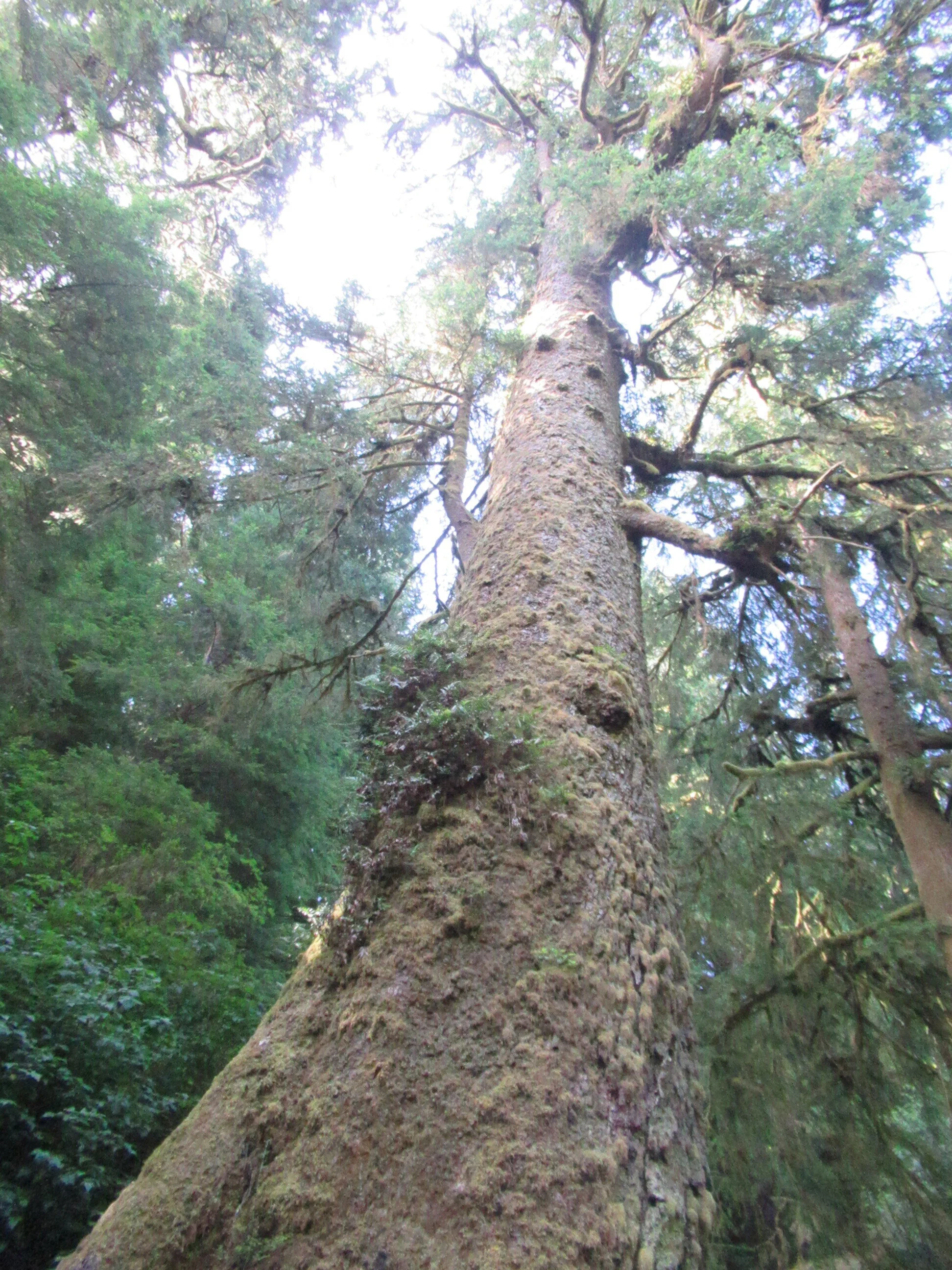
Second, is the Giant Spruce Trail. After hiking down St. Perpetua Trail, the Oregon Coast Trail goes left on the campground road for 100 yards, then turns right near a restroom. Within yards you cross a wooden bridge. The OCT goes right. Instead, go left on Giant Spruce, 0.8 miles each way. The Giant Spruce is 15 feet in diameter and the trunk bole is large enough for several toddlers. It may have lost 35 feet in height but it has survived nearly 60 years since the 1962 storm.
Total detour is 1.6 miles.
Third, is the Discovery Loop Trail. After reaching the Visitor Center, the Oregon Coast Trail goes to the right and down a paved path. Instead, go left and uphill to the RV parking lot 100 yards to the southeast corner. The trail is a total of 1.5 miles, and most days you can really hear the ocean on the segment before the loop. The loop itself has several signs about how forests are a continuing cycle of growth, death and change. There are benches in need of job security — and it gives you time to see what is around rather than just putting your head down to get the miles in. At the loop midpoint is Cook’s Ridge Trail and more old growth forest to appreciate if you like.
Total detour is 1.5 miles
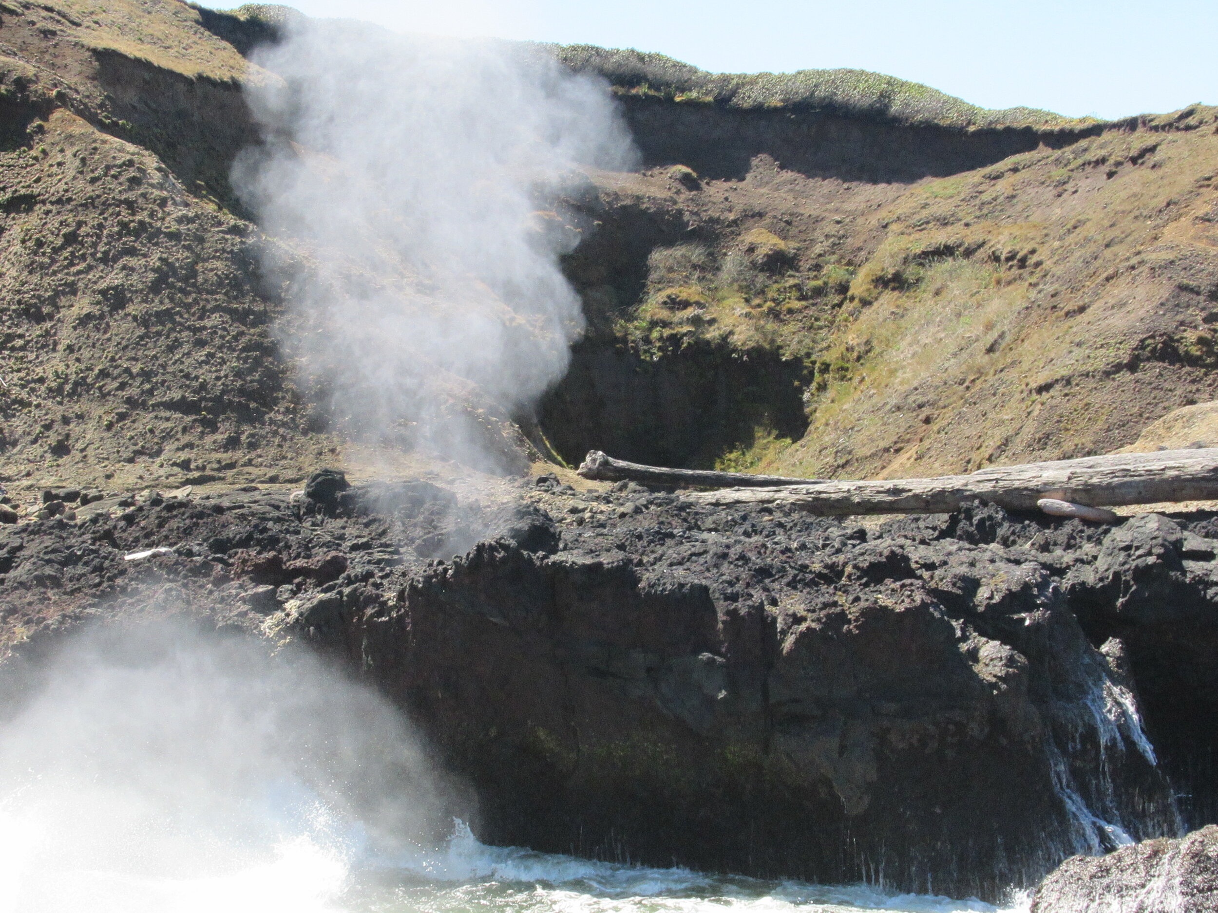
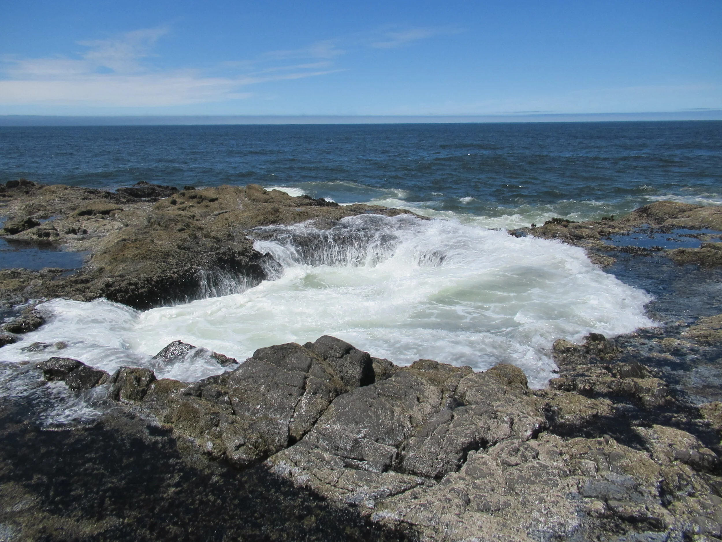
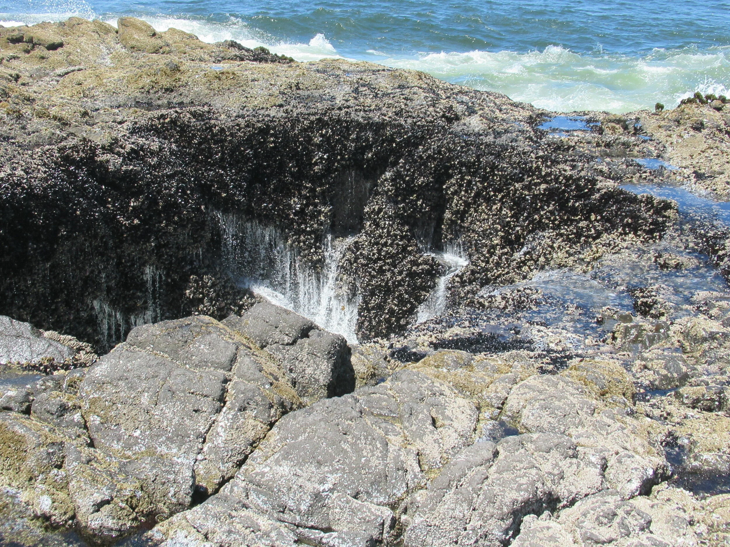
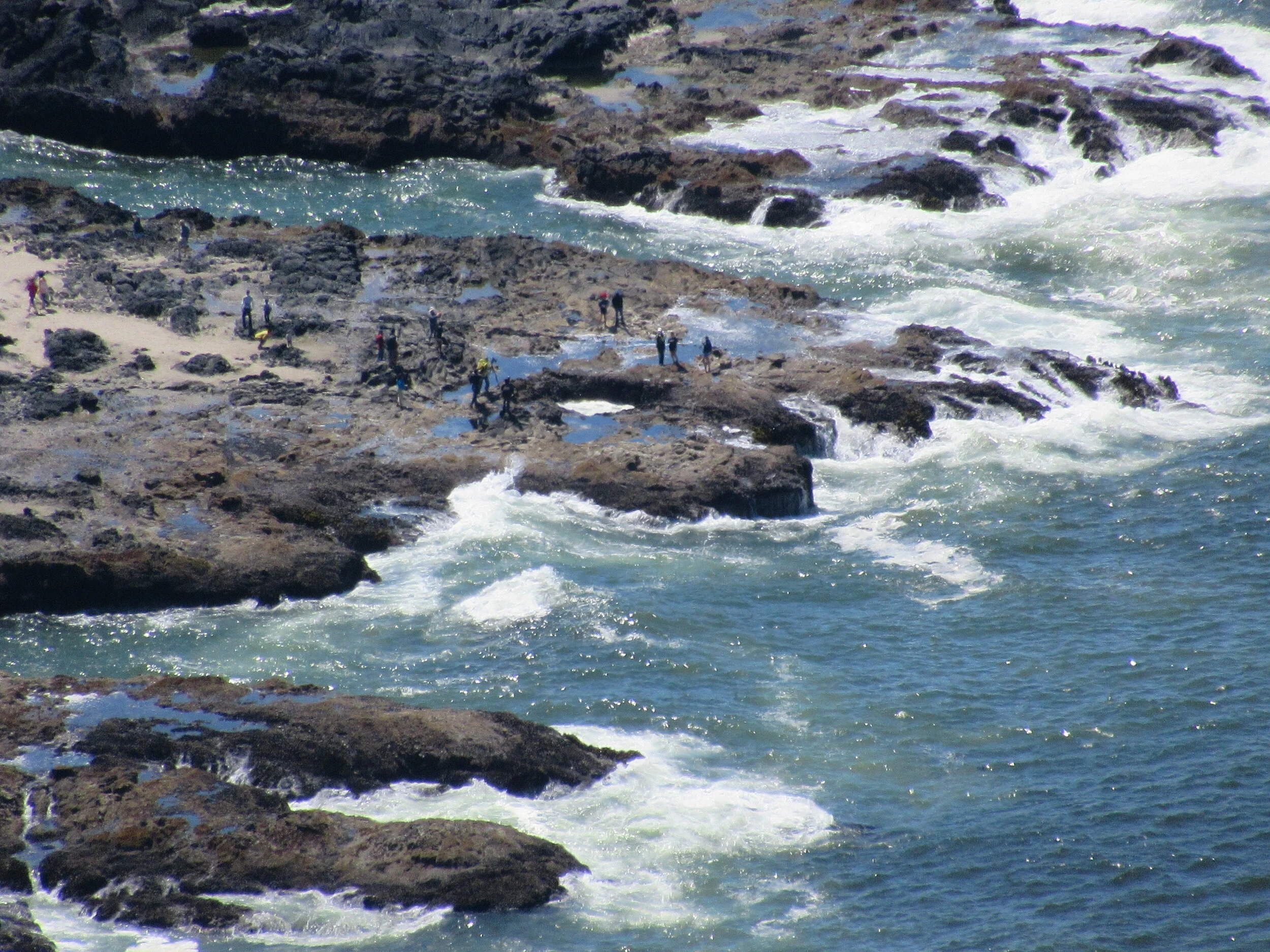
Fourth, is Thor’s Well and Spouting Horn. This is where having tide table is oh-so-helpful. Both are tide- and weather-dependent. Both are better at high tide, much better at the higher daily high tide, and spectacular if there are large waves thrown in for good measure. After going down the paved trail from the Visitor Center about 50 yards, the Oregon Coast Trail turns left. Instead, continue straight, take the tunnel under Highway 101, turn left and go a quarter mile to Thor’s Well/Spouting Horn steps and go down. The Spouting Horn is roughly south of the stairs and Thor’s Well is west northwest about 250 feet away.
After visiting them, you retrace your steps, go under Highway 101 in the tunnel, and roughly 250 feet, turning right/south to rejoin the Oregon Coast Trail.
Total detour is slightly more than half a mile.
Final Tally: 3.75 miles of picturesque opportunity with Dave’s Detour or just plugging along. It’s your choice.