
Oceanside offers detours aplenty

Every year when I head to Cape Meares to hike the Oregon Coast Trail, detours happen in Oceanside. I don’t know what to expect. I always try to match low tide so I can get around Maxwell Point if the tunnel is buried under debris. At first glance today, something isn’t right. Even at low tide, there is water not sand on the oceanside. I guess I have to chance the tunnel, and hope a slide doesn’t strand me (and others) on Tunnel Beach. Also, some years there are lots of birds at Three Arch Rocks National Wildlife Refuge, and today there were virtually none. The birds were in large number just to the south of Maxwell Point — an eagle on the beach before Happy Camp, while dozens of waterfowl are looking for lunch, plus numerous harbor seals at Netarts. You definitely need to take a camera.
First of all, the Cape Meares road is to reopen this year — scheduled for the end of October. It has been closed for a decade, since 2013, and us hikers will need to rethink our routes. The new road will have traffic. The Cape Meares Beach trail has mud, lots of mud, too much mud. Last year, on a Trailkeepers of Oregon work party, Ingrid put her booted foot down and only the sock came of the muck.
Walking down from Cape Meares toward Oceanside, the Oregon Coast Trail heads south to Symons State Scenic Viewpoint.
The first detour is Short Beach near Radar Road on the Cape Meares Loop Road (at roughly 3.3 miles) as you head downhill toward Oceanside. Short Beach is best in the summer and at low tide, otherwise it is ankle-twisting cobbles. The path down to the beach has 125 stair steps, going beside concrete-steered Short Creek. The bulk of the beach is north, including Larson Creek waterfall, which helped contain a beach fire several years ago. Even on beaches it is necessary to watch where (if even allowed) to have fires.
The second detour is to Oceanside Beach State Recreation Site. Coming further down the Cape Meares Loop Road junctions Highway 131 at Pacific Avenue. You could turn right, go to Oceanside State Park and reach the beach to Tunnel Beach.
Walking north on the beach you will find a tunnel roughly 50 yards in length at Maxwell Point. The tunnel was finished in 1926 and operated for many years until closed by a rock slide in 1979. It wasn’t reopened until the early 1990s. Further slides have occasionally closed the tunnel. On Dec. 5, 2020, there was a landslide and several people had to be rescued from the north side. The tide guide is important in case of a slide, especially if your luck is as “good/bad” as mine. I didn’t want to be stranded since you can go around Maxwell Point with sand gain in the summer — it wasn’t there this year.
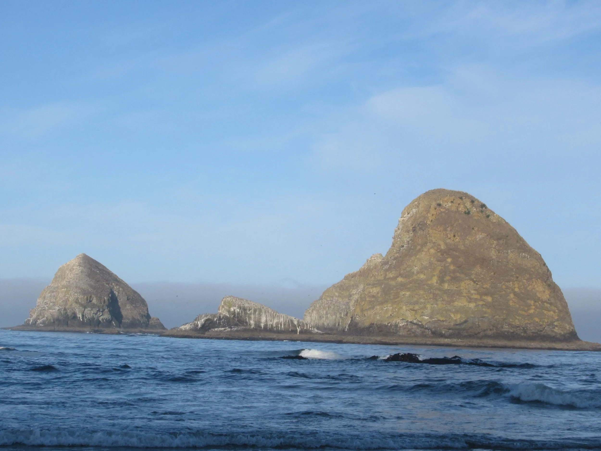
When you reach Tunnel Beach you are visually in the midst of Three Arch Rocks National Wildlife Refuge. Established in 1907 to protect nesting bird, it has three large and six small rocky islands just offshore, featuring the largest colony of breeding tufted puffins and a large common murre colony. The scenery changes seasonally and daily. Nesting season has bird noise and flights with meals for the chicks. It could be calm, with brown pelicans diving for lunch, or windy, for pictures of crashing surf over the rocks or flying kites, or a place to check out the tidal creatures.
After spending time at Tunnel Beach, go back through the tunnel and continue south on Oceanside Beach and about half a mile south you will rejoin the Oregon Coast Trail at Symons Viewpoint.
Final Tally: 2.5 miles (one mile at Short Beach and 1.5 at Tunnel Beach) of additional picturesque opportunity with Dave’s Detour before walking south to Netarts. It’s your choice.