
Detour No. 2: Yaquina Head

On Newport’s northside it is time to leave the beach, take Highway 101 around Yaquina Head and return to the beach. How to leave the beach for Highway 101?
It is an Oregon Coast Trail mystery! The state website removed old map #4, which contained instruction #4 “Hike past Beverly Beach to just short of Yaquina Head. Take beach access east to 62nd Ave. to Highway 101.” This route is through Pacific Shores MotorCoach Resort, which has had a “No Trespassing” sign on their beach stairway for years.
This problem was known and Newport was looking for a different beach egress. You can exit at 68th Street, it is a longer walk on Highway 101. Until two years ago, surfers used a makeshift rope to climb the cliff and exit at 55th Street — but the tree and attached rope fell into the ocean. Some surfers use a trailhead at 57th Street now.
After Yaquina Head is 20 miles of Oregon Coast Trail beach (except for Yaquina Bay Bridge and Alsea Bay Bridge crossings).
So, at Yaquina Head you could just walk a tenth of a mile down to the beach — or it’s Dave’s Detour Time.
Enter Yaquina Head Outstanding Natural Area.
Make a right/west turn at Lighthouse Drive, it has a traffic light.
Instead of going 100 feet on Lighthouse and then left/down Agate to the ocean, continue straight on Lighthouse Drive. Yaquina Head has three open trails, still closed is the Cobble Beach. If you can do only one, I suggest Salal Hill trail, followed by Lighthouse observation deck.

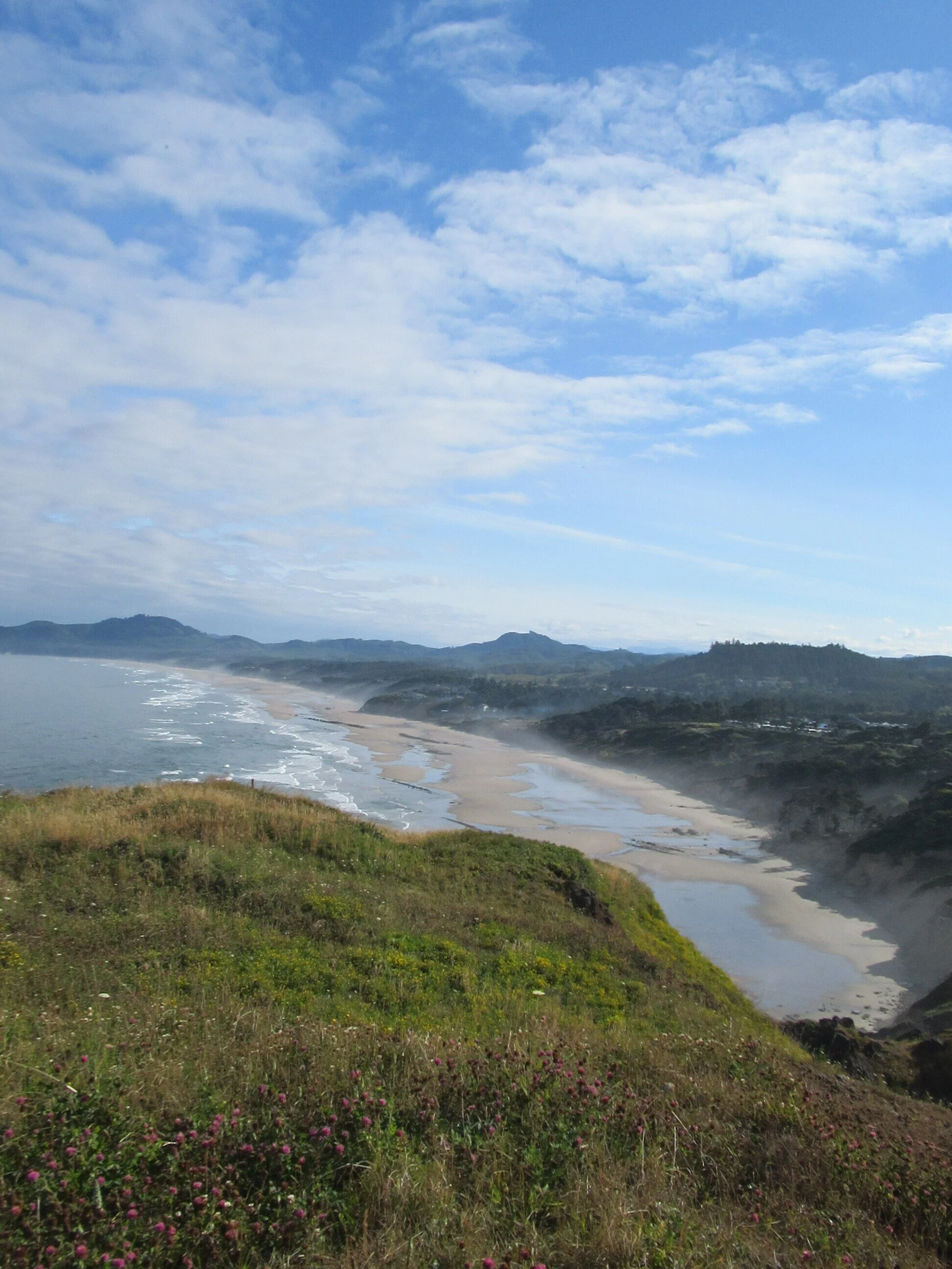
First is Communication Hill trail about half a mile from Highway 101 and on the right side. It’s an out-and-back trail of half a mile round trip (and I would like to say it is downhill both ways). It has views of where you have just been — Beverly Beach, Moolach Beach and Sea Star (formerly Starfish) Beach.
Returning to the main road, you travel west another half a mile to the second trail — Salal Hill. It starts at the small parking lot to the northeast of lighthouse circle. Salal Hill is another out-and-back trail covering three quarters of a mile and this has the best views. Various viewpoints look north to the beaches you already walked, look west to the lighthouse and south to the beaches you have yet to travel. It also overlooks the Visitors Center cliff — upon which is a nesting pair of peregrine falcons.
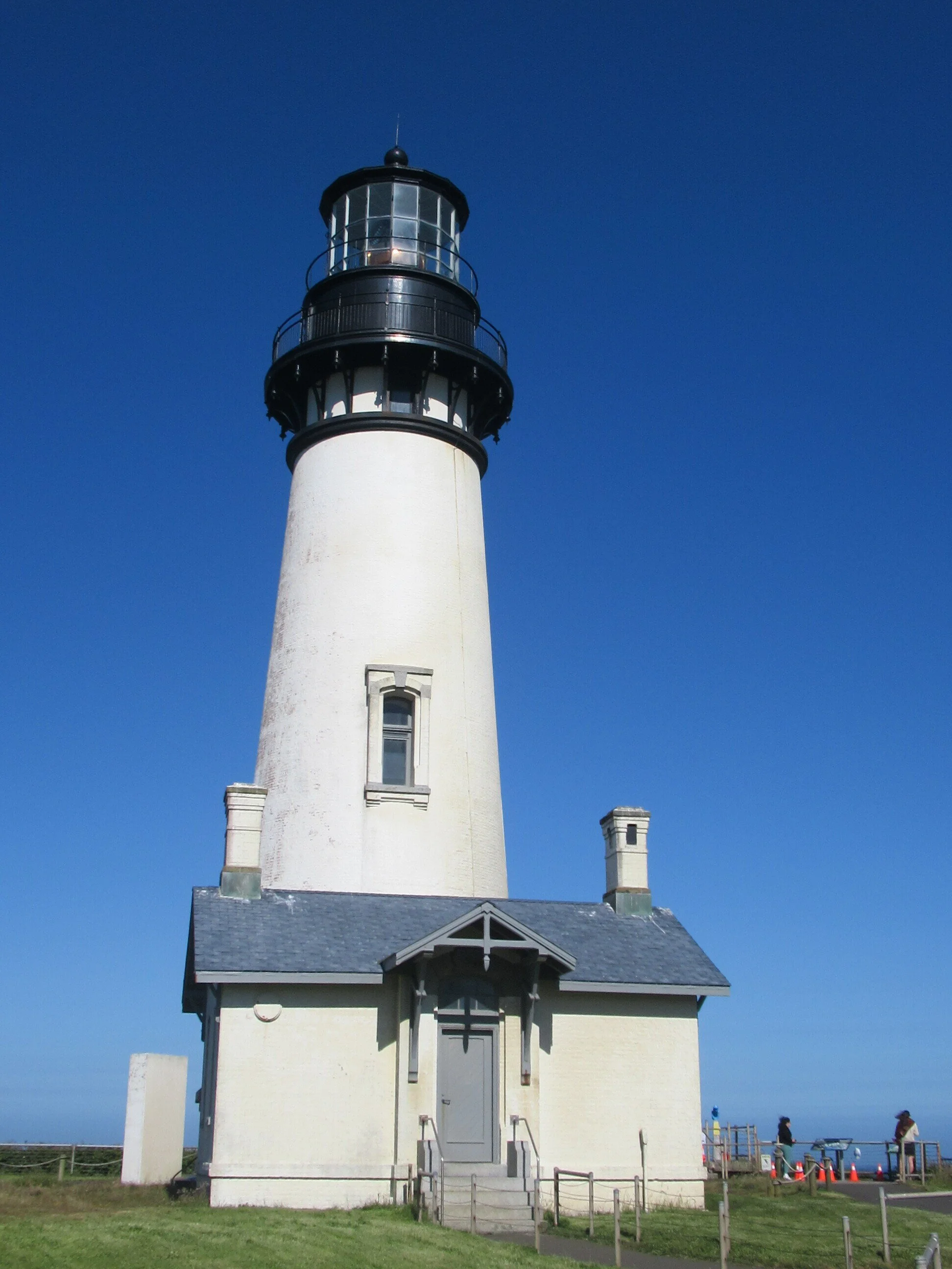
Salal Hill’s start is about 250 yards to the Lighthouse deck. A fast trip around should not be done. It is one of the best Oregon sites for whale watching. Major Hint: look for boats close by — they are trailing whales for visitors. Also, nesting nearby is one of the largest colonies of common murres — and there are other species of seabirds. Some stats about the lighthouse: construction started in 1871, started operation on August 20, 1873, tallest lighthouse in Oregon at 93 feet with 114 steps, and it has a first order Fresnel lens, which can be seen 20 miles away. Of course, until the virus this year you could walk up and earn a badge.
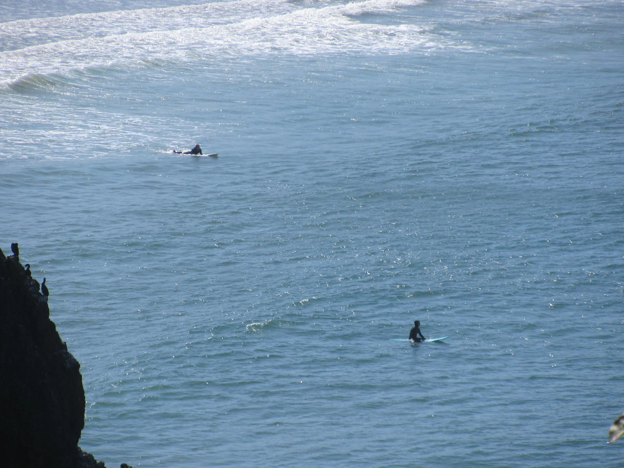
Leaving the deck, go west a quarter mile to Quarry Cove Trail, it is on the right/south side. You hike a quarter mile down with good views of beach, surfers, paddle boarders and, sometimes, kites being flown. At the parking lot trailhead, you head up and out a third of a mile to go to the beach. Or you can head further down into the quarry or the upper parking lot — it’s a quarter mile roundtrip both ways. I like both sections — a better chance to see marine mammals (usually harbor seals) and more time to watch people playing on the sand and ocean.
And I would add One Last Detour: instead of going down to Agate Drive to the Beach, you could continue south about 500 feet on Highway 101 to 49th Drive. There is a memorial for famed composer Ernest Bloch and a more secluded trail down to the beach.
Final Tally: 4.15 miles of picturesque opportunity with Dave’s Detour vs. a tenth of a mile of walking to the beach. It’s your choice.