
A ferry t(r)ail in Garibaldi


By Dave Powell
For the TODAY
For seven long years and way too many miles on Highway 101, Highway 131 and Bayocean Road (roughly 18 miles doubled for 36 when you park the car like I do — going out and back) I have followed the Oregon Coast Trail when passing Garibaldi.
This year, to heck with it — I needed a break. I took the alternate route, and quoting Robert Frost, “I took the one less traveled by, and that has made all the difference.” Or as my Cracker Barrel cap says, “I took the road less traveled ... now I’m lost.”
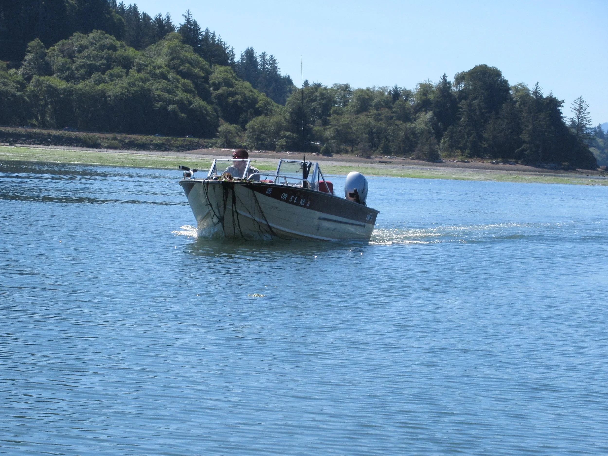
The Garibaldi Marina detour doesn’t allow restocking in Tillamook County stores but the distance saved was worth the money. It is under six miles via the “Powell Way” or five miles via two other routes.
The detour is easy: in Garibaldi take 7th Street toward the harbor, and about 50 yards past American Avenue is Garibaldi Marina. You need to call a day in advance and the cost is $50 for the first person and $10 for each additional person. If I can save the long walk, it is worth the price, even when the other person didn’t show.
A safe entry into the boat, a calm day, no waves or marine layer in order to land on the Cape Meares spit. Yes, this is better than roughly six hours of trudging on pavement heated by the sun.
After you land, there are three alternatives.
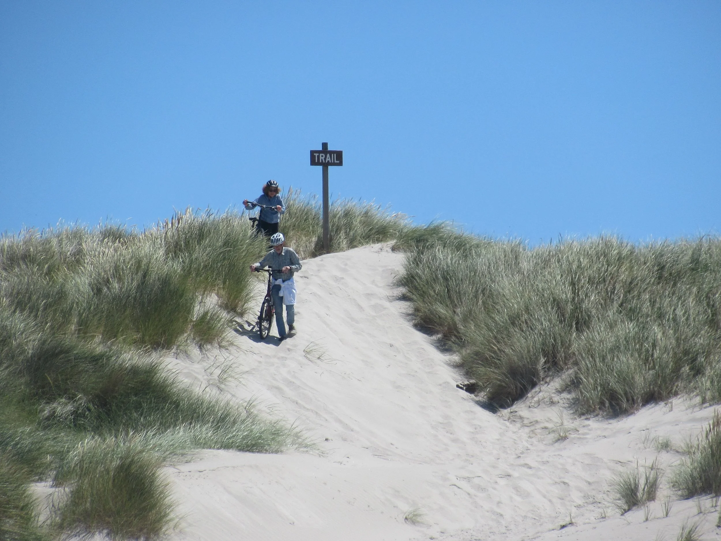
The first and second head south after landing. The first route continues on the Bayocean Dike road on the estuary side and then follows Bayocean to Cape Meares. The second differs at the half-mile mark, by heading to the ocean (the trailhead has a nice bench for a moment’s rest), then at the ocean you head south to Cape Meares. The second route has trail and beach — better in my opinion.
For the third way, the Powell longer cut, you head North-Northwest on the Bayocean Dike road until you hit the beach at the jetty. Walk on wet sand as the first mile of beach is protected for snowy plovers. Along the beach you get to see several posts announcing “trails” back to the estuary side. If you listen carefully, the sound of the Garibaldi trains can be heard over the surf sounds.
And about a mile before Cape Meares is Beach Access 29, Bayocean. This ghost town was founded in 1909 as a tourist destination complete with a hotel, a swimming pool and a boardwalk. If the developers asked the First Nations tribes, they would have learned the spit was not a suitable building location. After years of erosion, the Bayocean community was reclaimed by the ocean and finally abandoned in 1953.
During Bayocean’s heyday, the growing community, combined with the amount of lumber coming from the Tillamook forests, made safer harbor passage necessary. The US Corps of Engineers recommended two jetties to make the crossing safe and prevent sand loss. The $2-million price tag was too high and only one jetty was built, finished in 1917. In August 1928, a road linked Bayocean to Tillamook, but already several houses had fallen into the ocean. A storm in 1948 made the road impassable at times and in 1952 another storm made it an island. A breakwater was constructed in 1956, and today the Bayocean Dike road heads up to a parking lot near Bayocean.
Finally, this hike ended with a sight one doesn’t often see. People blowing bubbles big enough to be seen nearly a quarter mile before Cape Meares. What a way to end the most pleasant of my eight years’ worth of Garibaldi to Cape Meares hikes.
Final Tally:
The Garibaldi Ferry also takes passengers from the Cape Meares spit to Garibaldi for those hiking the Oregon Coast Trail northward.
A saving of 12 miles (six miles of trail and beach vs. 18 miles of road). Wow, a shortcut!