
Dave’s Detours: Cape Kiwanda

It is Wednesday, May 26. I am standing on the beach at Pacific City at Beach Access 37, near the Pelican Pub. I am looking north and there is RULE 1 visibly presented to me.
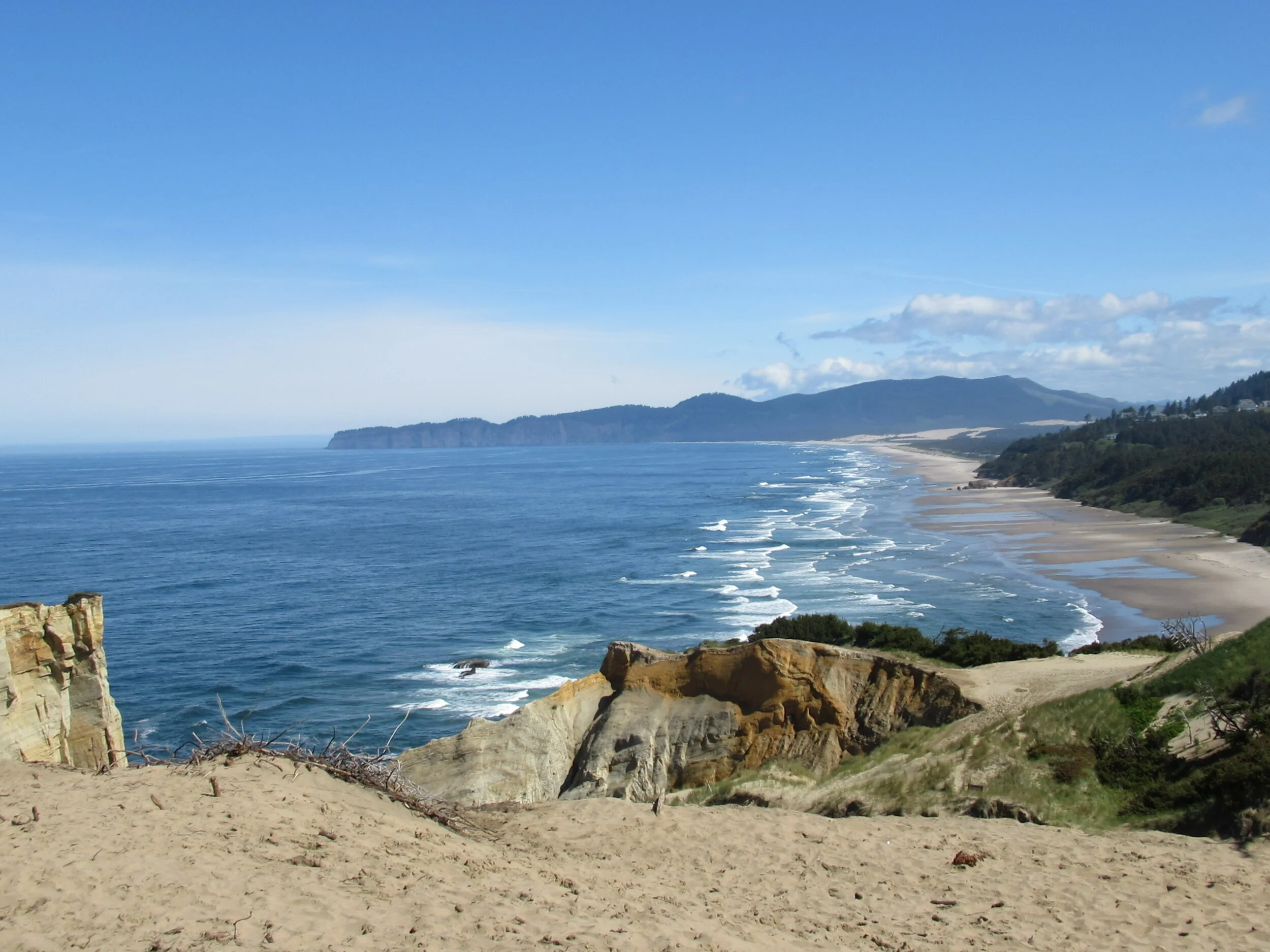
There is the right way — and it is to the right, the landward side of Cape Kiwanda. It is a walk of roughly 100 feet of elevation gain and loss of sand dune in half a mile to flat beach on other side heading toward McPhillips Beach. McPhillips was at one time considered as a site for a nuclear power plant. Much beach would have been lost, before you even consider the disaster that would follow when the Cascadia Subduction Zone produces another major earthquake.
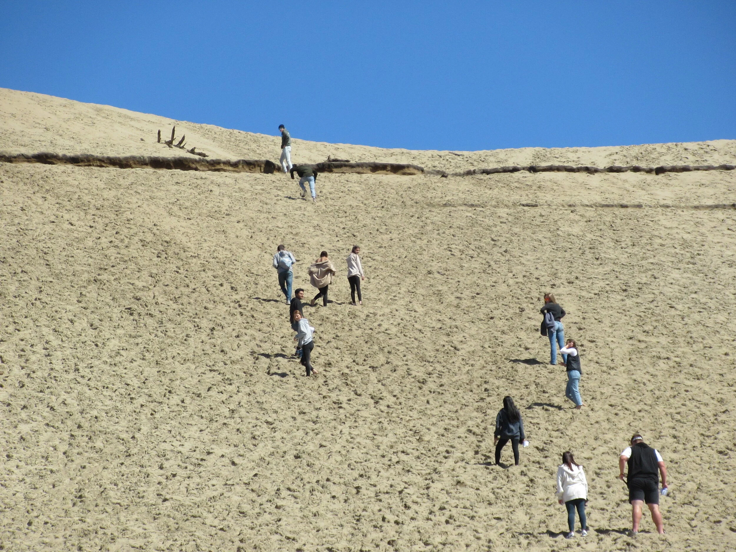
There is the wrong way — it is to go straight up to the highest point. And there are some people (about 10 to 12 at the moment) who are traveling it. It is a walk of roughly 200 feet of elevation gain and loss of sand dune in just over half a mile to the other side. It is also a steep climb on the sand, two steps upward then three steps downward loss in slippage (or is it the other way around?).
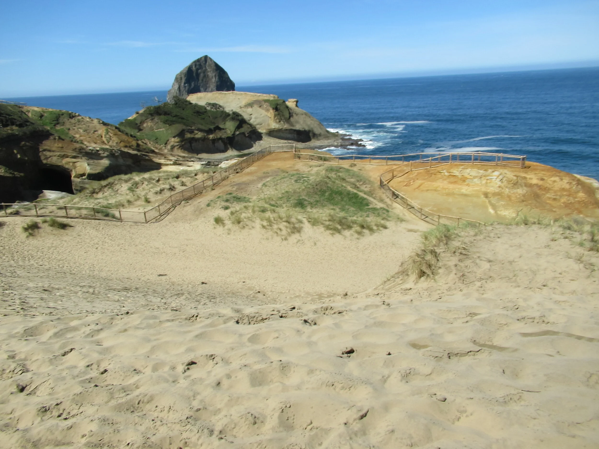
And then there is the Powell way. You head on the ocean side, using the new, and much better, fencing provided by Oregon State Parks as the boundary. Hopefully, the fencing will be honored and deaths become history. At the end of the fence it is steep enough to spur memories of Johnny Carson bantering with Ed McMahon (Johnny, “It’s So Steep!” Audience: “How steep is it?” Johnny, “It’s so steep they couldn’t even put in another post to close it off!”)
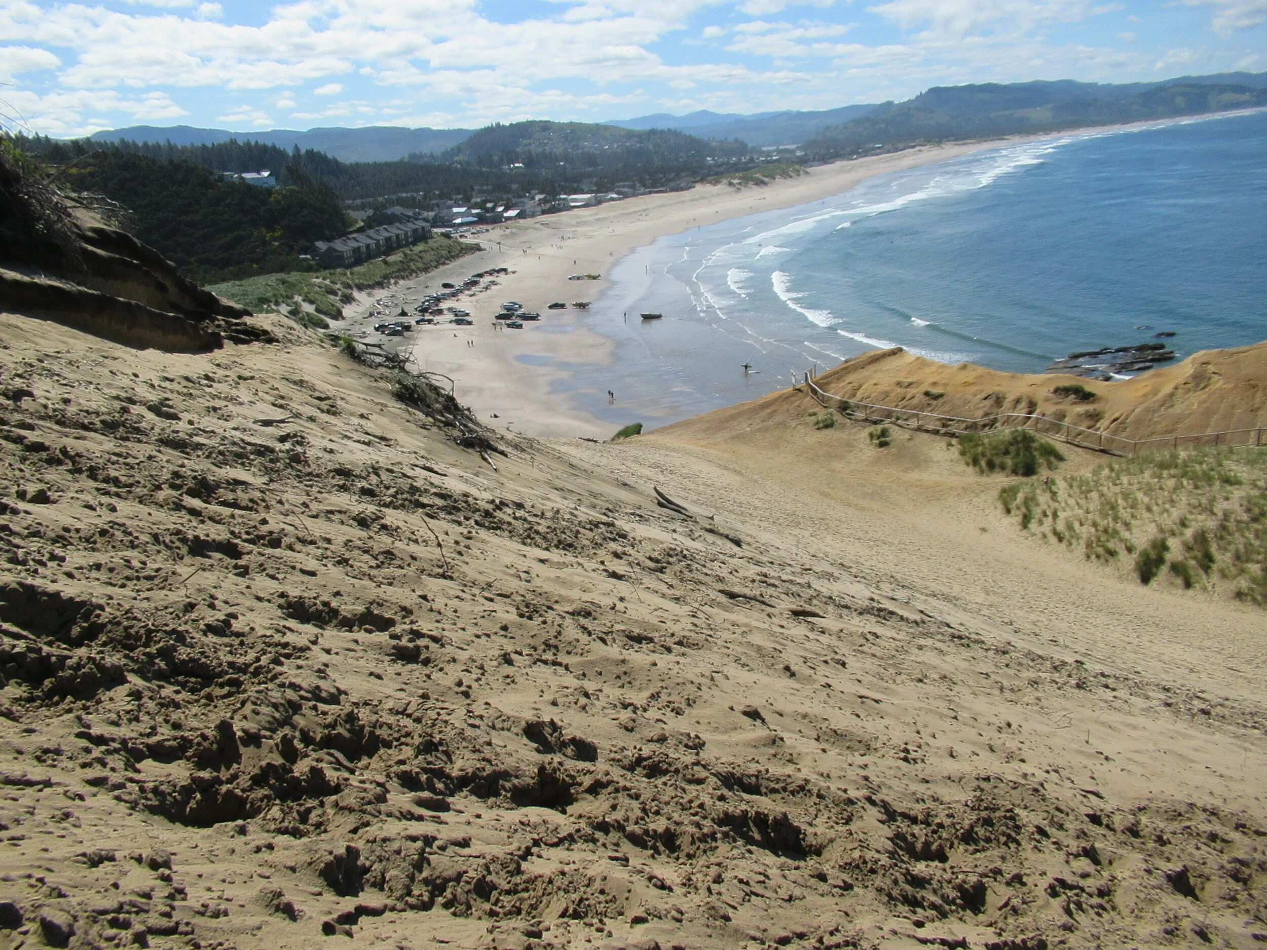
You head back south about 50 to 60 yards until you can take a path up to the top. At the top, you have a choice of scenic views. South to Cascade Head and Bob Straub State Park (named in honor of the man who, as state treasurer, helped prevent Highway 101 destroying the Nestucca Spit). South to the dory fisherman and Haystack Rock. West looking for whales. North looking at Cape Lookout and Sand Lake (with its Snowy Plover habitat). Heck, if there is a small kid, you can even watch them swinging under the tree swing at the top. I was taught that you don’t take pictures with children in them, so to see the sight you will have to climb it yourself.
Final Tally:
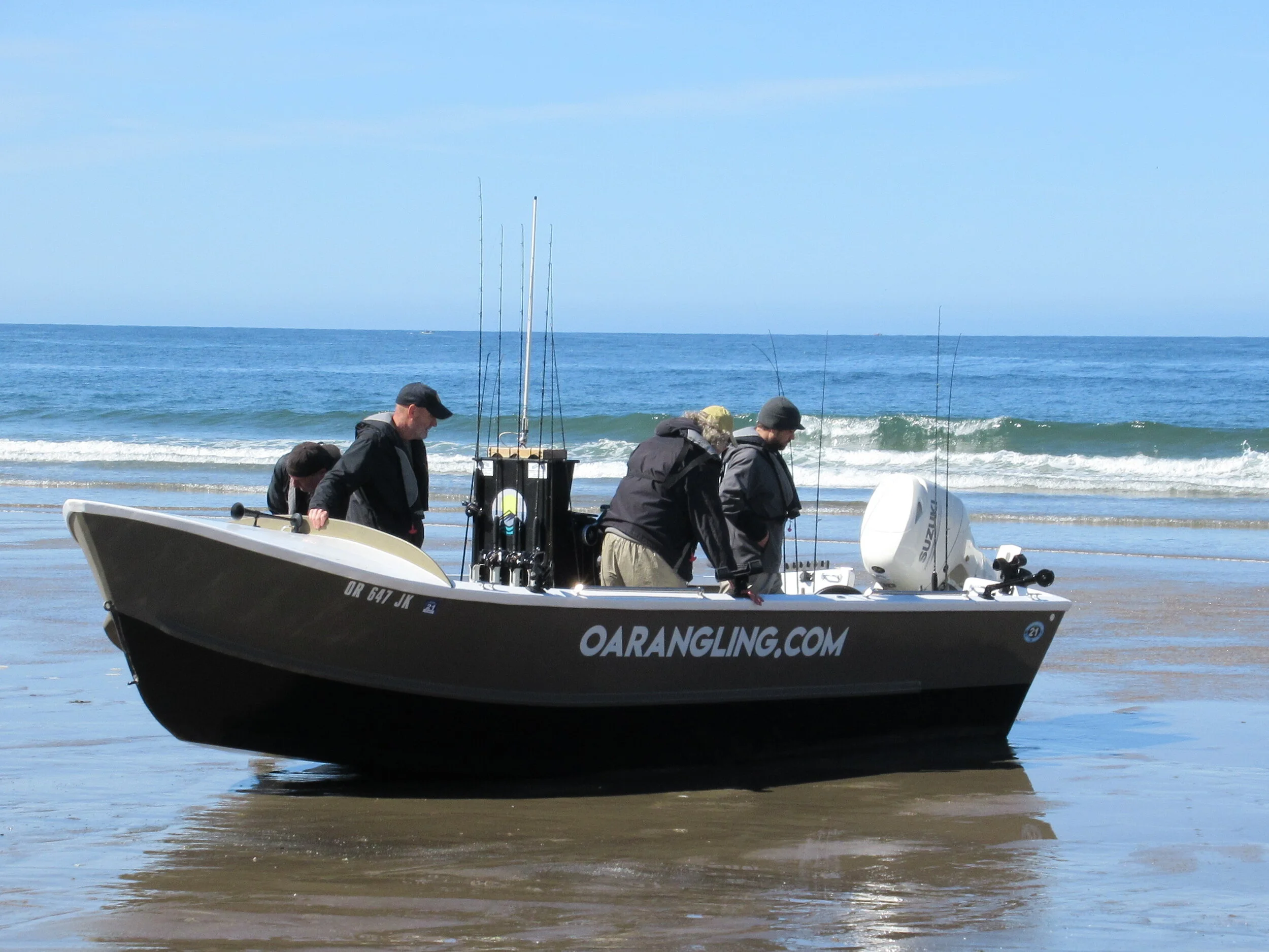
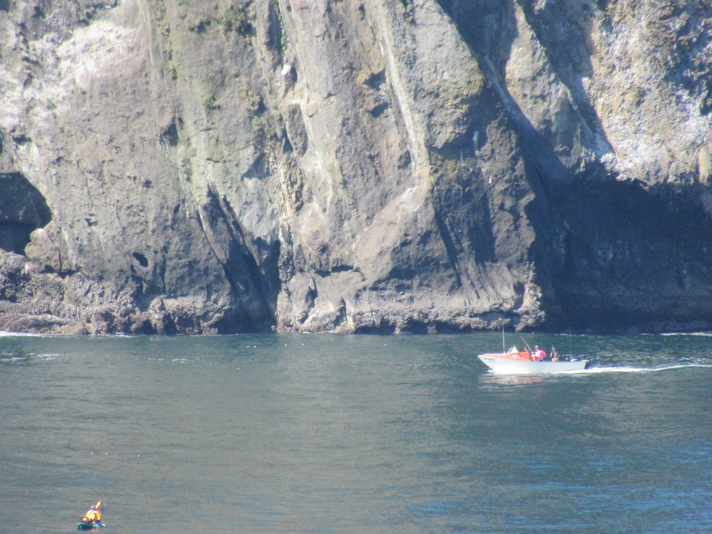
The Powell Way at Cape Kiwanda has an extra half a mile and gets to the highest point. But watching the dory fishermen going out and coming back — at ocean beach level and from above — is worth the time. And after what had to be a bad year for fishermen, restaurants and empty beaches, it is great to see activity and crowds. Also, with 100 feet of elevation at the fence or 200 feet at the highest point you can see 12 to 17 miles to the horizon. Compared to walking nearly two and a half miles to the end of the recently re-opened Cape Lookout Trail, it is much shorter and easier for watching for Gray whales.
Other good news
Oregon Parks announced on Monday, May 24, that the Cape Lookout Trail and the South Trail-which is part of the Oregon Coast Trail (OCT) are now open. The North Trail is still closed, probably for several years, as helicopters will be needed to remove acres and acres of downed trees. So, for this year (and Oregon Parks did release new maps for the OCT), a detour is given on the Cape Lookout website: “Oregon Coast Trail detour: hike south on Cape Lookout Road to the Cape Trail trailhead parking lot, where you can access the South Trail to return to the beach.”