
Off the trail in Lincoln City
Dave’s Detours
By Dave Powell
Hiking the Oregon Coast Trail doesn’t have to be merely putting one foot in front of the other. That makes for a long 425 miles. Instead there are different routes (I park my car so each section is a round trip-often with different routes for varieties of scenery. Another way to change the scenery is to time the hike to catch local events.
Tide Pool Explorience:
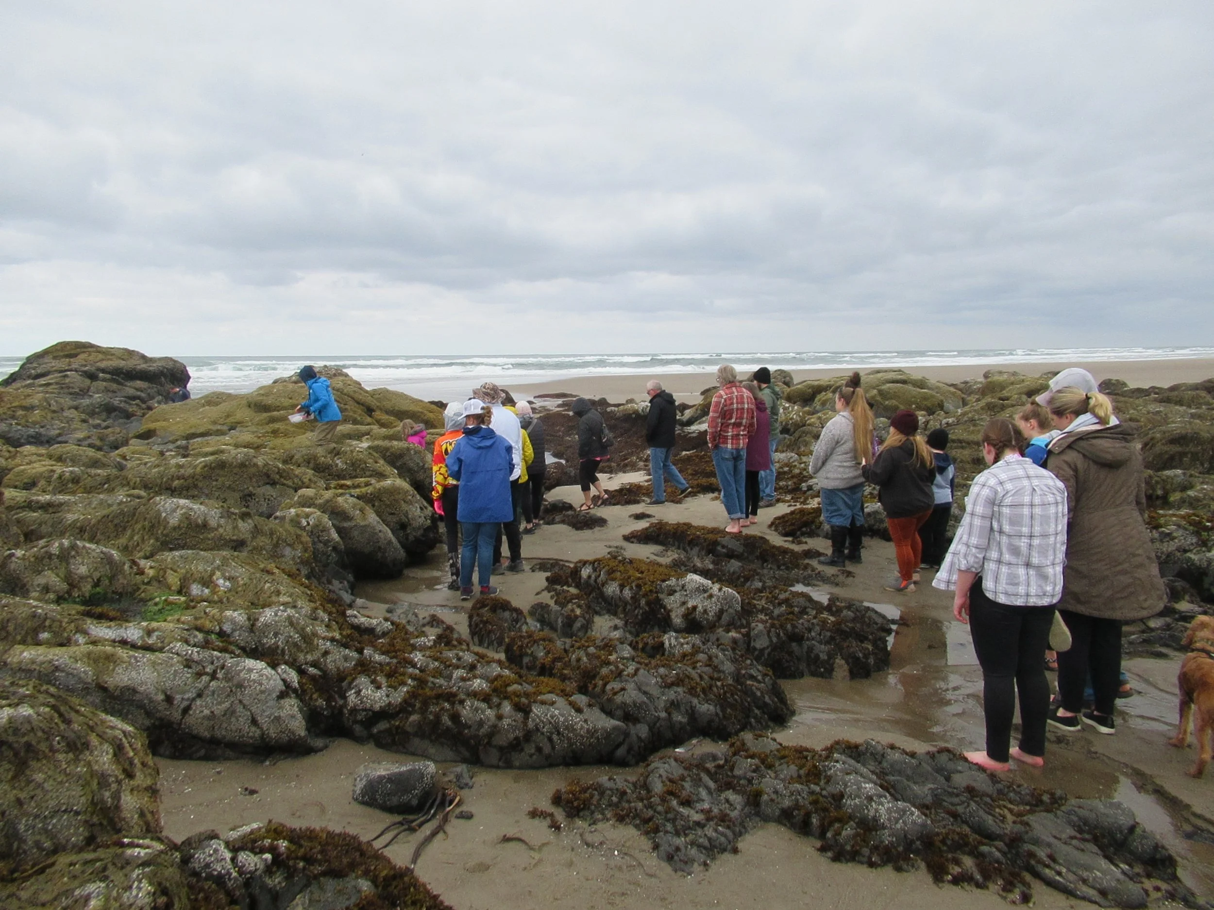
This Saturday and Sunday, June 18 and 19, at Lincoln City’s NW 15th Street is a chance to learn about tide pools. Oregon Shores/Coastwatch’s Fawn Custer and Athena Crichton will be present after a two-year COVID hiatus. Each has decades of experience, knowledge gained at Hatfield Marine Science. I was at an earlier event on May 20, when a total of about 50 to 60 people were present.
A much more colorful detour on the beach is scheduled for Saturday and Sunday, June 25 and 26, at the Lincoln City Summer Kite Festival.
For other events, go to www.oregoncoast.org and click the “events” tab.
Wood Carving
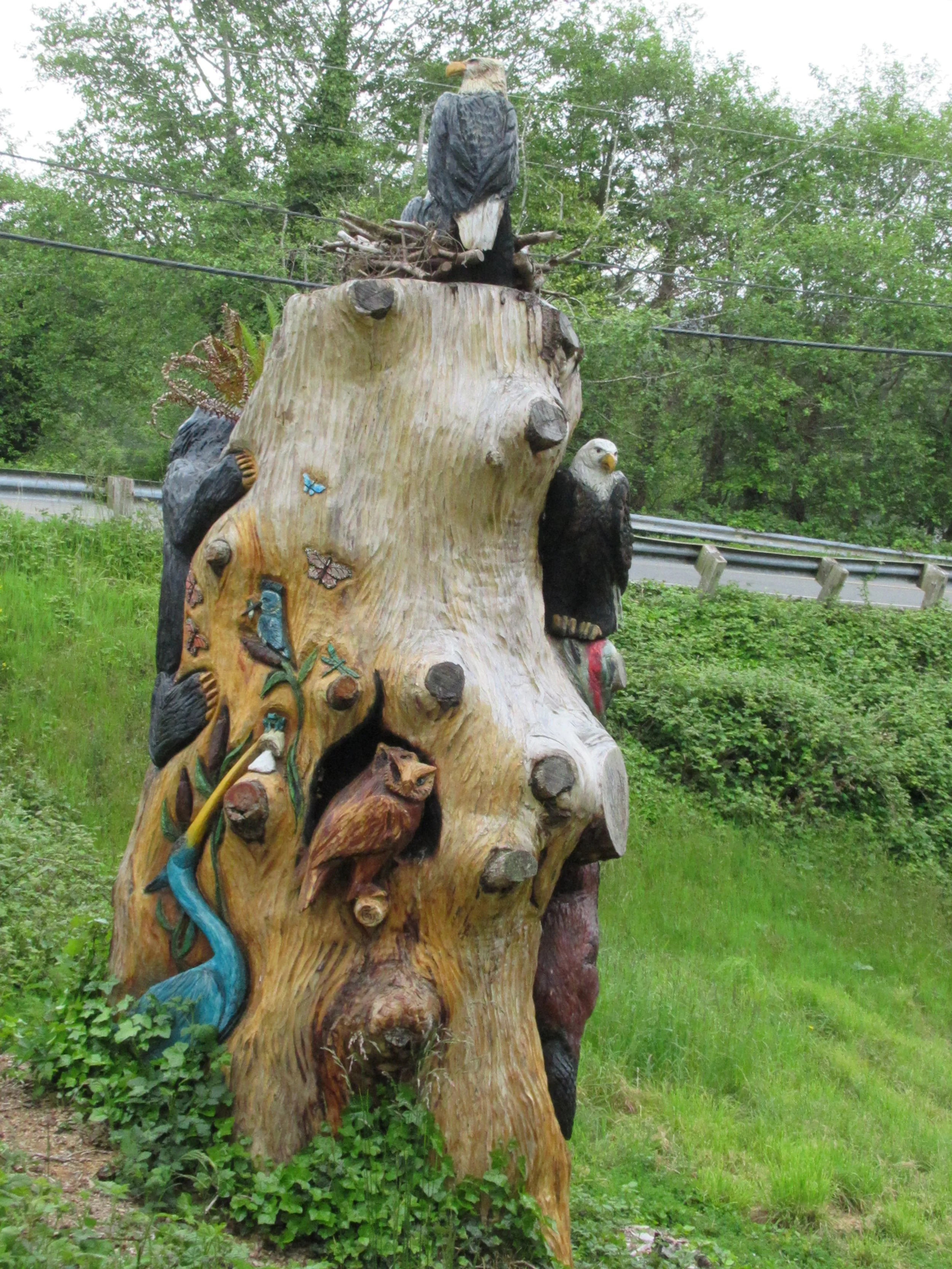
Walking along Highway 101 is boring. With all the beautiful scenery why are hikers reduced to pavement? Of the 425 miles of the Oregon Coast Trail 41 percent is on paved road. But here is a fortunate mistake of mine. At the north end of Lincoln City, I saw the sign for Head to Bay Trail, so I detoured off Highway 101 at NE West Devils Lake Road. I walked just 100 feet and saw a magnificent wood carving commissioned by Lincoln City Parks & Recreation Department to beautify the stump of a removed tree. The carving sits just yards from the Head to Bay Trail, a multi-modal trail for pedestrians and bikes, being completed in stages as funding becomes available. While the full trail doesn’t yet run all the way through town, it is worthwhile to leave Highway 101 for the carved artwork just 100 foot from the road.
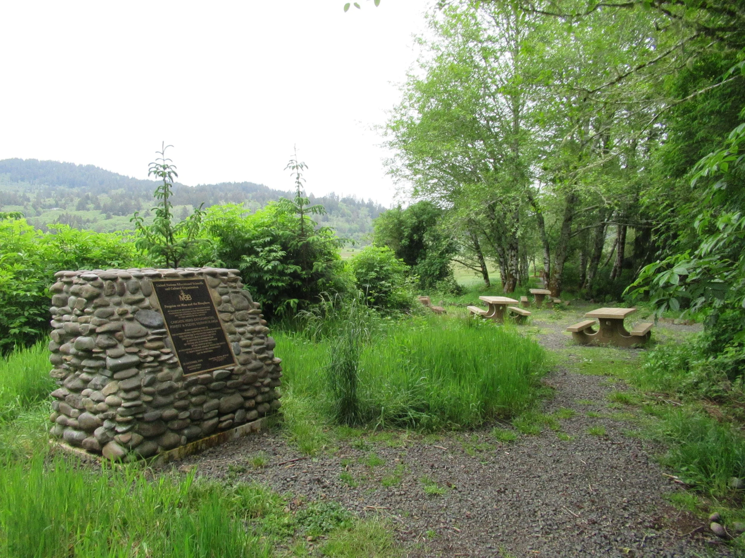
UNESCO Cascade Head Biosphere Reserve
Between Neskowin and Lincoln City is Cascade Head. What most of us don’t actively think about is its international importance. The Cascade Head Biosphere Reserve is a 102,110-acre site designated originally in 1976 on the Central Oregon Coast by the United Nations Man and Biosphere Program and reauthorized in 2017. About a quarter-mile south of the new pedestrian bridge over the Salmon River is Fraser Road, where a commemorative marker sits near a small picnic area.
New Trail idea
About half a mile from Highway 101 on Fraser Road is Rowdy Creek. What is amazing is what my handheld Garmin shows — I installed the Oregon 24K chip. It has several roads headed north into the marsh, and three roads headed south toward Lincoln City.
At the present the Oregon Coast Trail runs along the shoulder of Highway 101 from Fraser Road another 2.5 miles along Highway 101 and NW 40th Street to rejoin the ocean at Chinook Winds Casino Resort. What my Garmin shows is from Rowdy Creek it is only three quarters of a mile to the Knoll Loop Trail. From the Loop Trail you can weave a route to reach the beach at Logan Road with an extra mile of beach.
What I hate to think about is how long would it take to develop such a trail? The Buckeye Trail in Ohio was first thought of in 1959, finally completed in 1990. The Oregon Coast Trail was first envisioned by Samuel Dickens in 1959 (same year as the Buckeye Trail), approved in 1972, and is still unfinished. The only two “gap” sections completed lately were spearheaded by Trailkeepers of Oregon — I was privileged to work several days on each. How long?