
Take a light turn
If you hike the Oregon Coast Trail near Cape Meares you have to time the pinch point, about a third of a mile south of Pacific Avenue, with the tides. I usually try to catch it with a maximum tide height of about two to three feet. This really puts a time constraint if you opt for a ferry crossing rather than walk the more than 15 miles of road between Cape Meares and Garibaldi.
Second, there is the muddy and badly worn trail up from the beach to the top of Cape Meares.
Finally, the easy back route — the road, closed due to slippage, is now full of construction and closed to hikers.
I have a real like/dislike relationship here. In spring of 2016, I parked at the barriers that closed the damaged Cape Meares Loop Road and headed down toward the beach. But the beach trail had eroded, and I couldn’t get to the sands. So, after asking the volunteers at the lighthouse, I went to Cape Lookout to report this to the rangers. Some locals made a new trail connection. Like all fixes, it can’t be permanent. A new trail is needed, something further from the erosional beach zones — but I am not even sure that will suffice.
And as I write this, traffic to fix the new road limits the routes from the ocean to Cape Meares. Construction makes the old bypass of walking Cape Meares Loop road closed to hikers (at least during construction hours).
Now for this year’s three detours:
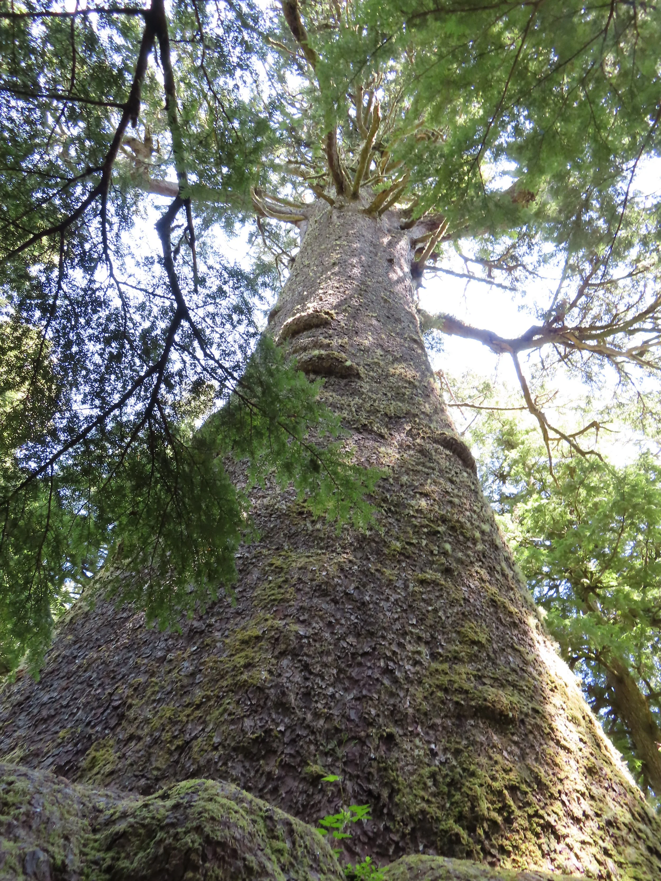
The first detour is Big Spruce Trail. After hiking up from the beach, about 50 feet before you reach the top near the road barriers, take the trail to the right. The Big Spruce Trail goes out and back about 1,000 feet, leading to a tree that has stood proudly for some 800 years. I remember a Trailkeepers of Oregon work party where we added several wood logs for steps. We would place a log in a wheelbarrow, push it uphill on the narrow path, set them in place, and have lunch under the shade of that huge tree. In 2008, Oregon declared it the largest spruce in the state, standing nearly 150 feet tall, with a circumference of nearly 50 feet.
The second detour is Fern Gully Trail. Instead of going right/west at the parking lot to the lighthouse, go left. Travel down the closed road about 500 feet, avoid the construction vehicles. Then take the Nascowitzen Trail to the Fern Gully junction, a distance of roughly 700 to 800 feet. While it has no clear ocean view, this is a short, quarter-mile loop. What I like is the cool breeze and the funneling of lots of ocean beach sounds.
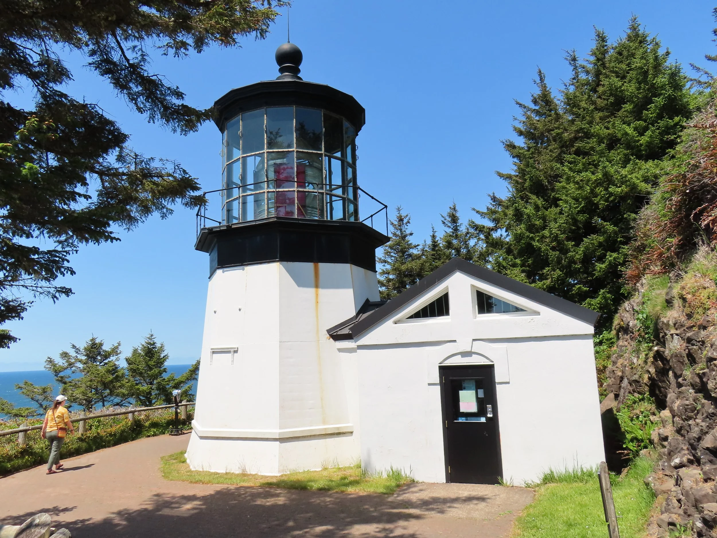
The third detour is from the main parking lot to the shortest lighthouse on the Oregon Coast. The distance out and back is about 2,000 feet. Walking out toward the lighthouse on the northern trail, birdwatchers can check the cliffs for birds. Three Arch Rocks Refuge, protected by Teddy Roosevelt’s pen, is only three miles away, so be sure to stop in Oceanside also.
At only 38 feet tall, the Cape Meares Lighthouse is the shortest on the Oregon Coast. First lit in 1890, its red and white flashes are still visible 20 miles out to sea. Tours of the lighthouse are limited to five people at a time when it and the gift shop are open, 11 am to 4 pm Thursday through Sunday, if volunteers are available.